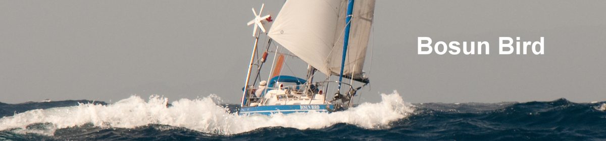
Cruising Haida Gwaii
The remote archipelago of Haida Gwaii – “Islands of the People” – consists of two large islands (Graham and Moresby) and some 150 smaller islands, lying 60 to 100 miles off the coast of northern British Columbia, between Vancouver Island and Southeast Alaska.
Although the Haida people have called these islands home for some 13,000 years, in 1787 Captain George Dixon of the Royal Navy re-named them as the Queen Charlotte Islands, after his ship (in turn named after Charlotte Mecklenberg-Strelits, consort of King George III). After politely enduring this name change for some 200 years, Haida elders gently “returned’ the name, written on a piece of paper in a traditional bentwood box, to the Premier of British Columbia in June 2010. Prince William later took the box back to Kensington Palace (London), where it now resides, and Haida Gwaii resumed its old appellation.
The high, forested islands, sparsely populated (4000 people for approx. 4000 sq miles) and host to many endemic species, are little-known, even within Canada. The weather can be wild out here (an alternative Haida name translates as “Islands at the Boundary of the World”) and for much of the year are alternately battered by storms from the Gulf of Alaska or enveloped in fog. But safe anchorages are plentiful and spectacular; as such this represents one of the last, great nearly untouched cruising destinations of the world.
We use the term “nearly” advisedly. While population density is extremely low, loggers reached the islands many years ago, after exhausting most of the accessible old-growth stands of cedar and spruce on the mainland. Haida Gwaii was famously the source of the spruce from which Mosquito bombers were built in WW2. But in 1985 Haida leaders decided enough was enough; joined by a motley crew of environmentalists, they blockaded logging operations on Lyell Island, by then one of the last untouched islands in the group. The protest attracted international attention and led eventually to the creation of a unique national park, protecting the southern third of Haida Gwaii, and jointly managed by the federal government and the Haida Nation. It’s to the national park that a few cruising boats gravitate each summer.
For cruisers coming from the west coast urban centers of Vancouver, Victoria or Seattle, it can take three to five weeks just to position yourself for the open water crossing from the mainland to Haida Gwaii. And sailors coming in from offshore or even from Southeast Alaska (whose mountains can, on a clear day, be seen from Haida Gwaii) are typically frustrated to find that you can’t check into Canada here – the closest port of entry is Prince Rupert. Furthermore, a permit must be obtained in advance if you wish to visit the national park – the total number of persons allowed within the park at any one time is 100 – with a fee payable and an in-depth briefing mandatory (this can now be done by a package received by mail).

North to the Rapids
We allowed ourselves plenty of time. Our strategy was to work our way steadily to the NW up the “inside.” We’d cruise the largely protected waters inside Vancouver Island and the network of channels that reaches all the way to Alaska, taking advantage of the southeasters that are still common in the spring and early summer to position ourselves at the point where Hecate Strait, the body of water that separates Haida Gwaii from mainland BC, is at its narrowest (about 60 miles). We’d cross over, cruise southwards through the park, then ride back to the mainland just north of Vancouver Island, once the prevailing northwesterlies of summer had set in.
 Late May in southern BC was sunny, the days warming up, the nights short. We meandered slowly north through familiar cruising grounds – the Gulf Islands – and took advantage of the fact that the school holidays and BC’s popular cruising season (July and August), were still two months away, to stop at locations such as Pirates’ Cove, normally far too crowded for our liking. Exiting the vast natural lake that protects the Gulf Islands and leaving behind us the snowy backdrop of Mount Baker, we passed through the first of several sets of tidal narrows that would act as gateways as we worked our way north – Dodd Narrows.
Such sets of narrows – the most famous of which is Seymour Narrows, where the current can reach 16 knots – can be intimidating to newcomers to the Pacific Northwest. And they do indeed deserve the greatest respect. But with conscientious scrutiny of the relevant current tables to ensure that you pass through at or very close to slack, they can be passed without incident (but definitely NOT under sail). The ideal is to arrive just before slack, while the current is slightly against you; edge forwards against the current in such a way as to be at the middle of the narrows at predicted slack, then the turn of the tide will wash you safely out the other side. It’s important to understand at the outset that the various tidal narrows that choke the N/S corridor in BC’s inner waters do NOT represent the points at which the tides that come around the southeast and the northwest ends of Vancouver Island meet;  that is an innocuous and unnoticeable open-water location somewhere near Mitlenatch Island; also, for complicated reasons, slack water does not necessarily coincide with high or low water.
From Dodd Narrows it was just 5 or 6 miles to a favourite location: the provincial marine park at Newcastle Island, off Nanaimo. The anchorage can get crowded but even on summer holiday weekends we have always found space on one of the mooring buoys; there is excellent walking through the woods of the island, and views across the Strait of Georgia to the high and snow-capped mountains of the mainland.
 An early morning start took us across the Strait (or Salish Sea as it is now known), past the lighthouses of Entrance Island and Merry Island, to Pender Harbour. Within reach of Vancouver by road (and ferry), this is another popular boating center, but was still quiet in late May. Next day we took advantage of a “dry” southeaster and ran at 5 knots all day, up Malaspina Strait on the inside of Texada Island, to Desolation Sound. The “dry” southeaster is a fair weather wind that is essentially an “inflow” or on-shore wind that has worked its way all the way round from the Strait of Juan de Fuca – where it will have taken the form of a westerly – and is to be distinguished from the more powerful, “wet” southeasters that come with major depressions in the fall and winter.
 The approach to Desolation Sound – so inappropriately named by George Vancouver – always takes our breath away, especially on a bright day: towering grey granite peaks, most still with snow at this time of year, encircling a network of deep-blue fjords and bays, with no permanent inhabitants other than the humpback whales that browse and huff gently. We anchored first at Cortes Bay, reached through a narrow gorge-like entrance; we had last been here in 1984; the small B & B in which my visiting parents had then stayed is now an outstation of the Seattle Yacht Club. Then we worked our way north to Squirrel Cove, on the east coast of Cortes. In summer there might be a hundred boats or more in here, but today we were alone.
  We took a walk to the shop at the nearby settlement of Squirrel Cove; the restaurant was not yet open for the season but we were able to warm some pies in their microwave. Back at the little jetty at the Squirrel Cove anchorage we chatted with some First Nation teenagers (this is an Indian Reserve for the Klahoose First Nation) who were loading some freshly-painted wooden crosses into their runabout; they were setting off to clean up the cemetery at an abandoned Klahoose village at the head of Bute Inlet.
Now we had a choice of exactly which set(s) of rapids to take as we forced our way through the maze of islands that almost blocks the way north. We could do the triple-whammy of Yuculta-Gillard-Dent (three narrows in the space of about four miles) but the timing was such that we would need either to approach in the dark or exit in the dark, neither option being attractive.
 Instead we opted for a more roundabout route where there were more anchoring options, and where we could spread the passage over several days. First, we sailed past the Rendezvous islands, then edged carefully into Whiterock Passage. Here the current does not run especially fast, but the Passage is very narrow and shallow – dredged in its central part; ranges help you keep in line, but it can be difficult to keep your eyes on the range ahead while constantly turning around to see that you are still lined up with the range astern.
 Just past Whiterock is the small settlement of Surge Narrows. But like so many of these once thriving outposts, that used to serve loggers and fishermen, and that often had their own little school and was perhaps served by a steamer, Surge is nearly defunct: one of its two piers had crumbled and collapsed, the other was occupied by small runabouts and a shack that now serves as the Post Office; the store, at the head of the two docks, was shuttered and there was a For Sale sign.
Had there been space, we would have tied up. As it was, we had a few hours to wait for slack at Surge Narrows (Beazley Passage), so we jilled around quietly, until the audible roar of the narrows had faded away and the tables indicated it was fifteen minutes to slack.  As always, once through we wondered what we had been nervous about – the water was almost flat – and as evening set in we ghosted under sail into the wide, quiet expanse of Waiatt Bay. Here we whiled away time waiting for daylight slack at the next set of rapids with some beautiful forest walking, then it was up at 04:35 to “hit” Okisollo rapids at slack.
From Oikisollo, the route takes you out briefly into Discovery Passage, the route taken by George Vancouver in his eponymous ship, then up Nodales Channel (a nod here to the Spanish who shared much of the first European exploration of these waters) on a rare, rainy day, to Bickley Bay. It was totally still at dawn next day; as we upped the anchor we watched a tug inching his way past the head of the bay, with a mile-long log boom behind him.
 Fortunately he was going the other way – you don’t really want to meet or have to pass a slow-moving, ungainly boom in rapids – and a school of Dall’s porpoises escorted us joyously to Greene Point Rapids.
Four rapids down, one to go. Frustratingly, we now had good wind just as we needed to go very slowly so as to hit Whirlpool Rapids, in Wellbore Channel, at the right time. So we sailed until we were a mile or so short, then tacked and motored back and forth for two hours, before biting the bullet and riding the downhill sleigh of Whirlpool a full ninety minutes before slack. A hard right into Forward Harbour, just at the exit of Whirlpool, and as we dropped the anchor in some 20m, a black bear appeared on the beach to watch us.
On to Haida Gwaii
Always, north of the rapids, the weather seems to change (for the worse), and the sailing starts to get more serious. For boats bound to the northwest (as we were), Johnstone Strait now looms. It’s just a strait and it’s enclosed by high mountains, but in the afternoons gale force inflow winds are more and more frequent as the season advances, and when these oppose the almost perpetual ebb current (the latter on account of heavy freshwater run-off from the interior), then steep, ugly seas form.
A vital asset, when sitting in Forward Harbour and contemplating the next leg, is the automated weather-reporting station at Fanny Island, just where Sunderland Channel meets Johnstone.
First thing next morning Fanny was already reporting 18 knots westerly (i.e. on the nose); that figure was only likely to rise as the day went on, so we went promptly back to bed (and were not surprised when the sole boat with which we had shared the anchorage returned with its tail between its legs, three hours after leaving).
 Fanny was quiet next morning, so we motored down Sunderland and, entering the wider Johnstone Strait, were even able to sail with the wind behind us, passing the once-thriving but now moribund Port Neville on our right before turning off the strait into Port Harvey. A Big Blow was now forecast, so we made for the wide, well-protected Boughey (“Boogey”) Bay, where we sat out a gale for a couple of days; reports of 60 knots on the west coast of Vancouver Island served as another reminder that summer was still not definitively here.
Listening to the weather on the VHF two or three times a day and comparing with a photocopied diagram we had obtained from Environment Canada, we were by now becoming quite familiar with each of the many lighthouses and other weather reporting stations on our route. Many of these stations derive their names from features or islands that were given their names by Vancouver and other Royal Navy captains in subsequent years. In that many light stations are in effect Mom & Pop operations, we would find ourselves wondering what Mrs Mudge, Mrs Pulteney, Mrs Chatham or Mrs Addenbroke would have for us today.  They seemed like a cast of names from a Dickens novel; and some mornings it would seem they had lain abed rather than make the 04:30 a.m. report (Pulteney would invariably report “Not Available” for that particular time). It pained us to conclude, after several weeks, that the automated weather stations and buoys were actually more reliable (and, moreover, reporting every hour).
Onwards through the Broughton Islands. We stopped to pick up diesel at Pierre’s at Echo Bay, a marina/resort that is packed out in high summer, but we shared it with only one other boat. The colourful, flamboyantly bearded Pierre (Quebecois) was fuming. He had just replenished his massive gasoline and diesel tanks in advance of the season, only to find that the barge had topped up his half-full gas tank with diesel, causing several small boats to cough to a halt several miles out (fortunately on a calm day). We took advantage of the quiet times to walk over to the neighbouring bay and here spent an hour being entertained by the stories of Billy Proctor, a legend in his time, possibly the oldest resident (he is well into his eighties) these days of the Broughtons.  At his own cost Billy has built a small museum in which you can find all sorts of memorabilia of the heyday of the “mainland” (as the locals call the Broughtons, to distinguish them from Vancouver Island); he has built a replica of the one-room elementary school that only closed a few years ago, and an authentic one-man hand-logger’s cabin. We took the chance here to pick some early salmonberries – red and yellow; just as well, because we would hereon find very few.
We passed Village Island, once a major First Nations village, and the setting of Totem Poles and Tea, the entertaining account of a young teacher who lived here for two years in the 1930’s. There are still a few beams standing from the great longhouses that once lined the waterfront but the totems and mortuary polls have all long since fallen and have been enveloped by the undergrowth. We had stopped here some thirty years earlier; it was an eerie place even then. At that time a tiny TB clinic was still standing, and you could walk about in a stoop, through tunnels among the blackberry bushes, made by black bears.
 After the Broughtons we made a final stop in Queen Charlotte Strait (that Queen again!), at the capacious Blunden Harbour. This also was once the site of a First Nation village, and as late as the 1980s, burial boxes could still be seen in the trees on the north shore of the bay. As at Village Island, a few roof beams can still be glimpsed, but the local community does not appreciate outsiders stepping ashore here.
 Cape Caution is an important milestone on the route north: the only place (prior to crossing Hecate Strait) where a vessel need step out into the open ocean as it heads north. The Cape is disappointingly low and undistinguished but it can be frustrating to round – from this direction at least – as the prevailing direction of swells and wind is from the NW, which is exactly the trend of the coastline. And you need to have an eye on the tides. Just south of the Cape is the innocuous-looking entrance to Slingsby Channel. This is one of only two outlets to a maze of several hundred miles of inner waterways; Nakwakto Rapids, a little way up Slingsby, run at 16.5 knots and – in full spate – cause a small island in its center to shake. When this massive amount of water reaches the open sea of Queen Charlotte Strait and is met by any kind of swell, the result is dramatic; this is no place to be when the ebb is running.
 We overnighted at Millbrook Cove, at the entrance of little-visited Smith Sound, but found that the navigational marker indicating an inconvenient rock in its approach was missing; next day we found it beached nearly two miles away and reported it to the Coastguard. Here we saw our first sea otter of this voyage. Sea otters were hunted almost to extinction in Alaska and BC, and the still small BC population is the legacy of the re-introduction, in 1969, of a small population at the Bunsby Islands on the west coast of Vancouver Island. The population is slowly spreading but the otters are still far from abundant.
 As we moved once more into more protected waters, heading up the wide FitzHugh Sound, we encountered a couple rowing a traditionally rigged whaler: a spectacle not often seen these past hundred years or more. Then, in a stiff beam wind, the great red Canadian icebreaker Sir Wilfred Laurier coming the other way. Fury Cove, the most picturesque anchorage in the neighbourhood, with its dazzling white clamshell beach, was surprisingly populated, mainly with American power vessels making an early start on the long haul north to Alaska.
 Past the abandoned cannery of Namu (even more ruinous than when we came this way, southbound last year) and on to the perfectly-protected but annoyingly deep Codville Lagoon. Here the crew of a boat that we had heard on the VHF that day, introduced themselves: David and Gillian, on Carousel. Over dinner that evening we were happy to find we had many mutual acquaintances; we stayed in touch by radio with Carousel and their friends on Pelagia for the next several weeks.
Shearwater is a small but well-equipped marina/shop a mile or two from the larger First Nation village of Bella Bella. Here we again re-stocked, but it was a short pause, as the current window of fair weather seemed to be closing and we wanted to make more progress before holing up for a few days. We found a good location in an inlet that has only very recently been charted, and which consequently is not on the cruising circuit at all: Lady Trutch Passage. As a wave of strong winds passed, we had a few days of wonderful walking at low tide on the rocky beaches, and one day, as we were rowing home, spotted a wolf loping along under the trees on the shoreline.


From Lady Trutch we moved north, then emphatically west, off the more popular variation of the Inside Passage that heads more directly to Prince Rupert. Accurate timing was once again needed as we moved through Meyers Narrows, where heavy kelp indicates the shallowest stretches, but where the current can reach 4 knots; there was an idyllic pool-like anchorage to one side where we spent an utterly still and silent night.
 Meyers debouches into Kitasu Bay, at the south end of Laredo Channel. This is one of the two or three major locations for the frenetic herring fishery that takes place in BC and Alaska in March each year: there were no fishing boats to be seen today, but there must still have been plenty of fish around, as a large pod of orcas was puffing around sedately, with humpbacks in company as well.
 The channels on this, the outer of the two main routes north, are wider, and the seaward-side islands, lower, so usually there is more wind for sailboats. But the currents can be just as strong and baffling; we had a counter-current of two knots for much of the day, in calm winds, which made for slow going. Evening found us off another recently-charted location: Emily Carr Inlet (after the artist who made her name painting in these waters). Depths were twice what was indicated on the chart – the crew does not appreciate anything more than 20m, as it makes for especially hard work hauling the anchor in the morning – but it was a another calm night so we did not need much swinging room.
 Caamano Sound, Estevan Sound, Principe Channel: one waterway succeeded another, and the only vessels for fifty or so miles around seemed to be Carousel and Pelagia (whom we could track on our AIS when not in visual contact). Caamano, with its bare, grey granite mountains, had a feeling of wildness and remoteness that reminded us of the western extremities of Tierra del Fuego: in winter these mountains take a tremendous battering from gales originating in the Gulf of Alaska. But help. If you need it, is not so far away as in Chile and Argentina. One morning we heard, after days of silence on the VHF, a Mayday call from a US-flagged power vessel that we had seen, in passing, a few days earlier, called Magic. The vessel was holed, sinking, and the crew was abandoning ship; the weather was calm and it was difficult to see how or why this had happened, but the Coastguard were on the scene within an hour, concerned not just about the crew (obviously) but about the full load of diesel that Magic would likely spill.
At Captain Cove, we ceased working north – by now we were nearly at Prince Rupert – and slid instead a little to the southwest, to a cozy secure anchorage in the Spicer Islands, to wait for favourable winds for the crossing of Hecate Strait.
Hecate has a poor reputation in British Columbia. Sixty to a hundred miles wide, 120 miles from north to south, this body of water separates the Haida Gwaii archipelago from the mainland. What makes it a potentially difficult stretch of water are its shallowness (much of it is no more than 20m deep, and cruise ships must stick to a relatively narrow channel up the eastern margin), the tides that come in from both ends with considerable strength (up to 3 knots) and meet in confused seas in the middle, and the strong winds that funnel in from the Gulf of Alaska – NW or SE – from either end.  The Spicer Islands and nearby Larsen Harbour are favourite jumping-off points because they allow for the shortest possible crossing (about 70 miles) and the angle of the crossing is such that either a NW or a SE wind will do.
After a couple of days at Spicer, during which we entertained ourselves by observing a local colony of cheeky, very aggressive mink, the forecast seemed innocuous enough – NW 10 to 15 knots – so we set off mid-morning, knowing this would be an overnight passage. In light winds we passed Bonilla Island to port (another of those reporting stations) but as darkness fell, what little wind there was came in bursts and was from WSW, exactly on the nose. It was an uncomfortable but not dangerous passage, with long periods of motoring into awkward-shaped seas (3ft-high pyramids) and the disconcerting presence of brightly-lit crabbing boats laying their (unlit) traps in 10m of water, up to 30 miles offshore. As dawn came up, one particularly well-lit boat revealed itself to be the BC ferry Northern Adventure. We followed it, at a more leisurely pace, inside a 10-mile long underwater spit, to Sandspit.
In Haida Gwaii
Not many people live here: some 4000 in total. There is a clutch of three settlements around the Narrows (Skidegate Narrows) where the two big islands of Graham and Moresby almost meet: Sandspit (on the south shore; with an airport); the misleadingly-named Queen Charlotte City (pop 900) on the north shore; and, adjoining Queen Charlotte, the mainly Haida settlement of Skidegate. The BC ferry from the mainland comes into Skidegate, but a smaller car ferry cuts across the Inlet to Sandspit.
Sandspit has a snug, walled harbour with a slightly intimidating L-shaped entrance. If only because this is the place closest to the open ocean, we moored Bosun Bird here for several days. Although Sandspit hosts the islands’ main airport, it is no metropolis; there is one shop, a few beachfront holiday homes and a campground that (at the time of our visit) was empty but which had a launderette. We’d decided to explore the northern island of Graham by car (there are no anchorages at all on its long eastern shore and only one indentation in the north), so it was handy being close to the airport – because this is where you can rent a car.
")
")
")
Our two-day road trip took us first by ferry across to Graham (as at home, you only pay one-way on the ferry), then through Skidegate and up to a community called Tlell, known for its artists and hippies but also a good base for some fine walks in the forest. Up on the north shore of Graham (reached after only 90 minutes’ on the islands’ only all-weather road) is Gaw (Old Massett) which, along with Skidegate, is one of the two principal Haida villages today. It’s a little run-down and untidy but the sight of sundry totems rising in apparently unlikely locations – there is a pair by the baseball diamond – is startling. It’s also encouraging. In the 1960s no new totem had been raised on Haida Gwaii for a hundred years. The Haida, all but wiped out in the terrible post-contact years by smallpox and demoralised by the misguided attempts of missionaries to destroy their whole way of life, were in a sorry state. Now there are seventeen poles in Gaw; Haida art is known and prized all over the world thanks in large part to the late Bill Reid; and, the language is compulsory in elementary schools and an option at high school.  The relationship between the Haida nation and both the federal government and the provincial government is at times edgy, and social indicators remain below the national average, but there is a feeling of pride and optimism in the air; a people that almost went to the wall are definitely back.
According to Haida myths, the first men were released from a clamshell by Raven (the trickster) on the long, tapering beach of Rose Spit, to the northeast of Gaw. It was an appropriately misty, rainy day when we drove out to the spit. The strange monolith of Tow Hill (which can be seen from Alaska) dominates the otherwise flat spit and its woods echo eerily with the raucous call of Raven and Eagle (all Haida belong either to the Eagle Moiety or the Raven; you must marry outside your clan).
 If you delve into Haida mythology and legends it is interesting how much they reflect what is now thought to be the true geological history of the islands. They refer to a time (in the relatively recent geological past) when Hecate Strait was dry and could be crossed on foot, when there were no forests here, and when the Grizzly roamed here as he does on the mainland. Human presence has now been dated as far back as 13,000 years.
From Gaw we drove half way back to Skidegate Narrows and spent the night at the slightly damp and Bates-like Golden Spruce Motel, at Port Clements. This is a logging town (or village) that briefly hit the headlines when, in a shocking act of eco-terrorism in 1997, a young ex-logger turned environmentalist felled a literally unique tree called the Golden Spruce. This was a genetic freak: a full-sized 200-yr old 165ft Sitka spruce covered with luminous golden needles. As such it had long been held in near-reverence by the Haida.  Grant Hadwin’s avowed aim was to draw attention to the extent of logging in what were then known as the Queen Charlotte Islands and to the damage it was doing to the entire ecosystem of the islands. He certainly got attention, but the condemnation of his act was universal. Hadwin pleaded that he had been unaware of the feelings of the Haida. He was arrested, cited to appear in court in Masset, then released on bail to Prince Rupert. Hadwin, saying he intended to keep his court date, set off by kayak to cross Hecate Strait (in midwinter) – and was never seen again.
  Although some time later wreckage of a kayak was found washed up on an island in Southeast Alaska, there were sufficient unanswered questions over the wreckage that many believe he staged his own disappearance. The story is told in a compelling book by John Vaillant entitled The Golden Spruce.
Attempts have been made to grow new grafts from the stump of the Golden Spruce; in a small, fenced enclosure in Port Clements you can indeed see a shrub-like 1m-high bush that has grown from one of these grafts; the jury is still out, but the fear – nearly 20 years on – is that this will turn out to be a “plagiotropic,” (i.e. a permanent dwarf) as have all other grafts from the same tree.
Port Clements is atmospheric in the rain. An extremely long red-painted government wharf juts far out into the mirror-still inlet, there are chunky log-shifting tugs tied up at the tiny harbour. It’s also slightly spooky.  The morning we left, a flotilla of sleek black SUVs cruised into town, and parked by a large but windowless shed. Out stepped pairs of traditionally dressed Mennonites – the men heavily bearded in odd black hats, the women bonneted, faces averted and wearing full-length Victorian-style dresses. No doubt they are benign (certainly they are locally famed for their produce) but this looked like the beginning of some off-beat scary movie.
 Back in Skidegate, we visited the impressive Haida heritage center, which is built in the manner of a traditional Haida village, with longhouses facing the beach, totems in front of every building. The collection is small but impressive. It must be frustrating for the curators in that most of the great totems that remained on Haida Gwaii by the 1950s were cut in half and shipped to places such as the University of British Columbia anthropology museum or the provincial museum in Victoria; thousands of beautiful, exotic items of traditional regalia were confiscated by missionaries and government agents when potlatch ceremonies were declared illegal (a law since revoked) and ended up in museums all over the world – only a few have responded positively to requests from the Haida that these items be returned.
Gwaii Haanas

The national park – the name means “Beautiful Islands” or “Beautiful Home”; it was voted the “Best” national park in North America in 2005 – encompasses most of Moresby Island and adjoining islands, starting some 30 miles south of Sandspit. After fuelling up (again as we were doing a lot of motoring), we took a counter-intuitive route north to cross the bar at an appropriate depth, before turning south again, hugging the eastern shore of Moresby.
We intended to enter the archipelago at Cumshewa Inlet where, conveniently, there is an automatic weather reporting station. Westerly winds were rushing out of the inlet in squalls though; these also deterred us from landing at the first abandoned village site we encountered, at Skedans.
 None of the village sites actually have secure adjoining anchorages, which seems surprising until you recall that, travelling by canoe, the Haida valued above all low, shingly beaches on which their craft could easily be hauled up; and, being a frankly warlike people, they also needed a good view of anyone who might be seeking to approach by stealth.
 Instead, we moved on to Thurston Harbour, which made for a long day’s run of almost 40 miles. Here we spent several days exploring. There is 100-year old logging debris in the trees just above the shoreline, and on a prominent point of land there is a half-overturned one-man cabin; we poked around inside and found waterlogged instructions for the maintenance of generators, but no other indication as to how long the site had been abandoned. At low tide more than a dozen cheeky and fearless raccoons came out to forage in the seaweed, compulsively seeming to wash their hands (hence their French name: “Raton laveur”). Fifteen years ago or more, many of the bays on this coast had heavy mooring buoys, placed by the Department of Fisheries and Oceans (DFO) for the use of all. These are all gone now, and we found a pair abandoned above the tideline. In many ways they were convenient, but the expense involved in their maintenance – and no doubt questions of legal liability – mean that DFO has now pulled them all up.
 From here on, we were sailing in generally protected waters, in and out of high, deep fjords, along channels between islands as high as nearly 1200m, some still with patches of snow. Approaching Crescent Inlet, we spotted two black bears turning over rocks on the beach in a preoccupied manner; this usually means they are less well-fed than usual and/or that the winter has been exceptionally hard.
  We could see from the colour of the vegetation that in the not-too-distant past there had been a logging road here, perhaps heading over to the exposed west coast, so we spent an afternoon of rewarding hiking through the woods; there was evidence of bears every few meters, so we needed constantly to make a noise. The Haida Gwaii black bear is actually its own sub-species, distinguished by the size of its jaw and teeth; skulls of grizzlies have been found but they have not been sighted in modern times.
On a mirror-still morning, with the steep mountains reflected perfectly in the water, we motored next day into Darwin Sound. Many of the islands and bays here are named after Victorian naturalists and scientists – Lyell, Huxley, Sedgwick – but the British who did most of the early (European) exploration also paid tribute to the Spaniard who was the first European to sight these islands, and named Juan Perez Sound after him. We found another idyllic, well-protected anchorage at Echo Bay; an inner lagoon almost dries at low tide but is a haven for pigeon guillemots, loons, sandhill cranes, oystercatchers and the ubiquitous ravens.


 To Hutton Inlet, then over a bar and into Matheson Inlet. In the evening as the tide withdrew, here and in most of our anchorages deer would come to graze, some with this year’s fawns carefully tracking their mother. But if you saw bear, you weren’t going to see deer. From Hutton it is possible to continue inshore, via the very narrow and drying Burnaby Narrows, but we had no appetite for leaving any of our bottom paint on the islands, so we took a longer, offshore route to Ikeda Cove. On the way, near Joyce Rocks, what sounded like pitiful human calls for help caught our attention; on close examination, it was a noisy, hyperactive colony of Steller sea lions hauled out for the mating season.
Ikeda was once the site of a Japanese-owned copper mine, and high on a hill at the head of the bay you can see a pile of old tailings. We had read that here were a couple of Japanese graves to be found; we were not successful in finding them but the hunt gave us an excuse to explore both shorelines over the next couple of days. All but buried in the woods are rusting train tracks, remains of steam boilers, and in the mud flats at the head of the bay are the great timber rafters of the sternwheeler Dawson, later used as a bunkhouse.


Ikeda Cove
More noisy sea lions on Garcin Rocks as we edged our way south to the last decent anchorage of the archipelago, a few miles north of the iconic Cape St James: Rose Harbour.
 Until the 1940s there was a small whaling station here, and you can still see two large rusty oil storage tanks on shore; the market for whale meat dried up suddenly with the attack on Pearl Harbour and whalers never returned to Haida Gwaii. There are also three houses, the only private property in the national park. These serve as rustic B & Bs and lodges for kayakers, but their hold is tenuous; the forest seems ready to push them into the ocean.
 There is a buoy here, maintained by the national park, and we were happy to tie up to it for a few days, as swinging room among the kelp beds and reefs is limited. Our objective now was somehow to get to the most well-known of all the abandoned village sites in Haida Gwaii, S’Gang Gwaay better known as Ninstints. “Somehow”, because the only available neighbouring anchorages are poor: open to prevailing winds, with poor holding and tight. Happily, Patrick, who runs one of the three lodges along with his Thai wife, agreed to take us along next day in his high-speed RIB, along with a small group of Japanese tourists that would be flying in by Beaver from Queen Charlotte.
S’Gang Waay is a deeply moving location. The great memorial poles seen in those grainy pictures from the second half of the nineteenth century have all fallen or been removed to museums, but the Haida elders long ago agreed that the village’s mortuary poles – which are like tombstones, but in the form of 4 to 6m-high carved poles, with apertures at the top for bentwood boxes in which the remains of the deceased were placed – should remain. They have also decreed that just as they decay naturally, they shall not be maintained or replaced. So you have a sense of great privilege, of seeing something that all too soon will disappear for ever.


Fifteen or twenty poles still stand, some tilting crazily, against a background of deep forest and facing a well-protected shingle beach. Some are half-rotted, one has fallen horizontally; none bear even a trace of the paint that adorned them 150 years ago. Here is a grizzly, with his great cheeks and large eyes, here a wolf with his sharp teeth, here the raven and the eagle with their differing beaks; each post describes the lineage of the deceased. On one, you can see the copper nails where a copper shield has been removed; these shields, passed on over generations and exchanged ceremonially at potlatches, were symbols of great status. Behind the poles are the remains of just one great longhouse; two of its corner beams still stand and we imagined winter here, with forty or fifty family members crowded around the fires of each of the fifteen or so houses that made up the village.


Behind the village is a a steep cliff, not easily scaled. Here at the time of raids (which were frequent), the women and children would be sent for safety, with a supply of boulders to throw down on attackers, should the need arise.  Elsewhere is a cave where dozens of sets of remains have been found, likely dating from the dark days of the 1860s when smallpox reduced the population of Haida Gwaii from an estimated 7000 to only 400 and S’Gang Gwaay was abandoned..
The sites are guarded by Haida watchmen. Our guide, David, was half Haida, half Italian and it was moving to hear him tell the stories associated with every pole, flashing backwards and forwards to recount anecdotes of his childhood growing up with his grandmother in Gaw. In the winter, David worked for an outfit in Vancouver that specialised in traditional indigenous dishes, and every summer he came home to work at the six or seven sites where the Haida maintain watchmen in his home islands. He tells the myths legends as facts, and with a degree of pride and certainty that somehow you don’t want to question him and contradict him with “facts”. I do not know what the inscrutable Japanese tourists made of it.
Coming home

 Sailing home was downwind – and faster. From Rose Harbour we steered southeast, towards Cape Calvert, a distance of some 130 miles. For the first time in two years we activated our trusty Aries wind-vane which had us romping along at five knots with no need to touch the tiller. The wind picked up briefly to gale force as we rounded Calvert, but soon we were once again in Millbrooke Cove, greeted by the same sea otter who had eyed us passing through a few weeks before.
 We re-stocked and refuelled at Port McNeil, on Vancouver Island, then made a diversion to a place we had not been since 1984: the largely First Nations community of Alert Bay, on Cormorant Island. Thirty five years ago this was a thriving fishing community. Photos show the harbour absolutely crammed with fishing boats; the fish are all gone now; in eleven weeks we saw only crabbers at work, not a single commercial fishing boat. The looming, sinister (Indian) residential school that dominated the skyline in 1984 has, happily, been knocked down, but there are more totems than ever, many of them brightly painted and newly-commissioned: another sign of hope.
We then wended our way south again, largely on the same route we had used coming north – but this time passing through the triple rapids of Dent-Gillard-Yucultas. By now the summer boating season was upon us, with a vengeance. Passing through Yucultas at the same time there must have been twenty or so other vessels, including a grotesque superyacht called Kogo. Later we looked it up; it had cost USD $86m to build, measured 72m and was now owned by a Hong Kong property tycoon.  We were not surprised to find that, as seems to be usual in the case of such ostentatious displays of wealth, the owner had chosen to save a few dollars by registering it under a flag of convenience. It gave us some satisfaction NOT to move out of his way when he wanted to overtake us in Gillard Passage.
 In calm winds we made our way back to Cortes, then onto Comox and Hornby Island, where we had never stopped before. Hornby has a reputation for being a little off-beat and funky, much as our home island – Salt Spring – did a few years ago. However, more to the point, it has only one all-weather anchorage: Ford’s Cove. As it turned out, a wave of strong southeasters meant we had to spend several days here at a friendly but cramped marina that was half-full of derelict boats. Although the place was secure enough, a significant swell rolled in, so we were happy to be able to get off and take some long walks, notably along the fabulous south-facing cliffs. We were also happy to be able to spend some time with Salt Spring friends Michael and Lynn, who were on their way north to Comox in Selyna Rose.
From Hornby it was an tranquil passage to Newcastle Island once more, where by chance we met up with some more old friends: Guy and Claire from Quebec, on Balthazar, last seen several years ago in Prince William Sound shortly after they had successfully negotiated the Northwest Passage. Dodd Narrows next day was uneventful (apart from the number of boats now lined up) and at last – 11 weeks and 1300 miles out – we were back in our home waters: the Gulf Islands.
For an account of our 2025 cruise to Haida Gwaii, click here, and for more detail, including GPS positions, see Notes for Cruisers – Haida Gwaii.
More: Beyond the Rapids