
 For the summer of 2019, we decided again to head north up the coast of BC, to a destination usually overlooked by cruisers: Seymour and Belize Inlets, just south of Cape Caution and 300nm northwest of our home base on Salt Spring Island. This cruising ground – upwards of 150 miles of spectacular waters, with many safe anchorages – is often ignored because it is a distraction for cruisers in a hurry to reach or leave Southeast Alaska, and it lies behind one of the fastest sets of tidal rapids in the world: Nakwakto.
 Leaving on June 1, a full month before our home waters start to become crowded but with the stable weather of summer starting to establish itself, we obeyed the common wisdom and – after a night at Clam Bay and the transit of Dodd Narrows at slack water (max current 9 kts) – headed north across the Strait of Georgia in the hope of finding “inflow” southeasterly winds along the mainland coast. It was a pleasant run of 45 miles to Pender Harbour, with the hoped-for southeasterly in the strait, coupled with a flood tide, moving us along on a reach at 4 or 5 knots for most of the day.
 No such luck for our next leg to Lund, the gateway to Desolation Sound and the ballyhooed northern terminus of the Pan-American Highway (in fact Prince Rupert, close to the American border, is also accessible by road, but this involves a massive loop of over a thousand km inland). We’d last been to Lund nearly 30 years earlier. It has not changed greatly, but the Lund Hotel, once the hangout of all manner of hippies and end-of-the-roaders, has now gone respectable as all those hippies have graduated into prosperous middle and old age.
  There was some satisfaction in that this time around, as we pulled in by boat, we could also say we had been to the other end of the Highway by boat: Puerto Montt (Chile), some 15,000 km to the south.
Sailing past the always spectacular entrance to Desolation Sound, we made next for Squirrel Cove on Cortes Island, which often hosts 100 boats in mid-summer, but which today only hosted five or six. There was thunder and lightning in the night, and next day we observed that a wildfire had started on nearby Read Island – it had already been called in, and later in the day we heard firefighting helicopters buzzing around. We were worried, like many, that this year would be another horrendous year for wildfires in BC, but cooler weather meant that there would be a reprieve for 2019.
 Now we were approaching the barriers that deter many cruisers from heading north beyond Desolation Sound into waters that are just as beautiful but a lot less frequented: the tidal rapids that are formed where a maze of islands and narrow channels obstructs the way forwards and into the more open waters of Queen Charlotte Strait. These rapids cannot be avoided. The most straightforward route is that favoured by the cruise ships: Seymour Narrows. But this is very busy with commercial traffic and runs fast – up to 15 knots. So we usually favour some other combination that leads through rapids that are quieter in every sense, even though it may mean negotiating up to seven separate sets of narrows.
The favoured technique in every one is the same: approach with the last of the adverse current, aiming to arrive at the centre of the narrows at slack (the timing of which can be precisely calculated, but which does NOT necessarily coincide with high/low tide). Then, hopefully, you will be washed out of the other side as the tide turns and gathers speed. In all of the narrows in this region, the tide floods from the north to the south. By definition, the constrictions are in protected waters where steady and predictable winds are rare so it is neither advisable nor practical to attempt transits under sail;  moreover, even in the less frequented narrows, with at best one “opening” per day (in daylight hours) you could well find yourself coming around the bend and facing a tug pulling a 1km log boom, who needs to be given lots of room.
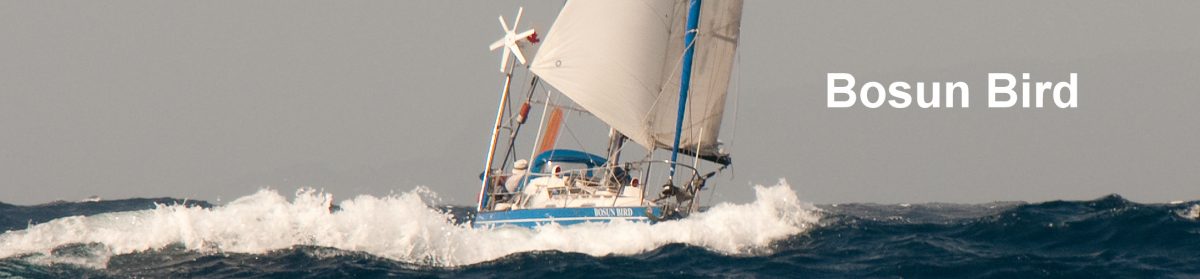
If possible, it is desirable to time passages to coincide with neap tides, when currents are much less strong and the consequences of mistiming are less severe. But with the low-powered Bosun Bird another important consideration for us is the ability to find secure anchorages both before and after transit, that we will not have to leave/approach in darkness (stray logs, often in large clusters, are a major deterrent to night-time navigation here).
 This year, we anchored in the marginal Florence Cove, in Okisollo Channel, so as to be at the southern entrance of Yuculta Rapids (pronounced, for unknown reasons, as Euclataws) at 07:30 a.m. Once in the position recommended by the Sailing Directions and still a full hour before slack, we took advantage of the predicted back eddy on the western shore to begin our transit though Yuculta, then Gillard, then Dent: a triple whammy of narrows, the last of which – when in full spate – spawns the much-dreaded Devil’s Throat. This is a wickedly powerful whirlpool that roams up and down, over one kilometre, and which has been known to sink average sized commercial fishing vessels.
We anchored that night in Bickley Bay: three rapids behind us (not counting Dodd Narrows, in our home cruising grounds), but still three more to go before we faced the strongest of all at Nakwakto. Another early start next morning for Greene Point Rapids, then a few hours waiting at Shorter Cove (depth 27m: a bit iffy) for slack at Whirlpool Rapids: here the flow is laminar (i.e. few whirlpools, notwithstanding the name) so we took the risk of speeding through on the last of the ebb, down Sunderland Channel and into Johnstone Strait.
 The central section of Johnstone Strait (which cannot be bypassed) is perhaps the most difficult sector – potentially – of the entire Inside Passage. There is an almost permanent ebb current, notably in spring and early summer (caused by run-off), and most afternoons this is opposed by winds of 20 to 35 knots, creating steep and sometimes dangerous seas.
  It’s very disappointing, therefore, that Environment Canada has allowed the one and only automated weather reporting station along this stretch – Fanny Island – to fall into disrepair, with no schedule set for fixing it. But today was unusually calm and it was with relief that we snuck into Port Neville, off the Strait’s north shore, at 18:00. Like so many places on the coast this was once a thriving little logging and trading community, home for a hundred years to a legendary general store and post office, but the community at the head of the government dock is now abandoned.
Next morning, another stretch of Johnstone Strait before we turned right into Havannah Channel, and back into a maze of well-protected channels. In the space of one afternoon, as we made for our anchorage at Boughey (pronounced Boogie) Bay, we saw no less than six black bears, one a large mother with two cubs, another an exceptionally powerful male as large as most grizzlies.
Yet more rapids next day (Chatham Narrows), plus a grizzly on the shoreline, then a hard right into Cutter Cove. This is a steep-sided rectangular bay with an extensive green meadow at its head.  Walking at low tide in the meadow we could make out in the mud the remains of a long-disappeared dock, while some bleached timbers on shore showed that there were once homesteads here; our explorations were cut short by a too-close sighting of yet another black bear.
 Over the next few days, we meandered our way through the Broughton archipelago. At Dead Point we explored the ruins of a homestead deserted since the early 1900’s and then we spent a day at the abandoned indigenous village of Mimkwamlis, on Village Island (formerly known, incorrectly, as Mamalilikulla). We’d last been to this haunting site in 1990. As expected, the long-abandoned houses were more dilapidated than before, the undergrowth higher, but there still stand the massive supporting poles of an old longhouse, and – almost indistinguishable from fallen logs – the moss-encrusted remains of two totems, the more eerie and evocative for their abandonment.
Hughina Harold wrote “Totem Poles and Tea” about the years she spent here as a nurse in 1935-7, hosted by two dour British missionary women. She describes her arrival, aboard the government’s Black Raven:
“The whole place was deathly still, a stillness punctuated only by the odd wisp of smoke pluming from one of the tin chimneys…The backdrop for this drab cluster of houses and totems was the forest, its trees – thick dark and impenetrable – reaching into the very sky….My heart sank”.
Mimkwamlis, 1990
")
")
")
")
")
")
Hughina came to love the place, but in another Canadian classic called “The Curve of Time” “Capi” Blanchet recounts that she also found Village Island – which she visited one summer in the 1920s – eerie. She and her children came, when the islanders were nearly all out fishing.
“…when we landed, no chief came down with greetings, no one sang the song of welcome, only a great black wooden figure, standing waist high in the nettles up on the bank, welcomed us with outstretched arms. It was Dsonoqua, of Indian folklore, who runs whistling through the woods, calling to the little Indian children so that she can catch them and carry them off in her basket to devour them”
Mimkwamlis, 2019
")
: compare with 1990")
")
")
: compare with 1990")
")
Working our way back from the Broughtons over to the Big Island, we encountered the cruise ship Queen Elizabeth in fog off Malcolm Island, then tied up for a few days for re-provisioning – and a little R & R – at friendly Port McNeill. One day we took the BC Ferry from here back to Malcolm and wandered around the tiny community of Sointula. This means “place of harmony” in Finnish. The settlement was founded as a socialist commune in 1901; the harmony didn’t last long, but the dominant building in “town” is still the Co-Op and Finnish names still predominate.


Taking advantage of a relatively unusual southeasterly, we began working our way once more to the mainland, and the approaches to Nakwakto Rapids. First stop was a tiny, well-protected cove in the midst of the often windswept Walker Group, in Queen Charlotte Strait. From here on in, we would see very few boats – maybe half a dozen in three weeks, and we had every anchorage to ourselves.

There are two approaches to Nakwakto. Slingsby Channel, which is three to four miles long and which runs west-east, off Queen Charlotte Strait, is ostensibly the most straightforward in that it is quite wide and unobstructed. But the current runs at up to 9 knots, and should there be any swell at all in Queen Charlotte Strait (which here is, basically, the open Pacific), then the effects of a strong ebb meeting ocean swells can be very severe indeed.  Much safer is the shorter Schooner Channel, which runs south to north for about two miles; this is narrow and should not be negotiated in poor visibility, but the current is much less (3 to 4kts max) and there are anchorages at either end that are out of the current.
We waited in Allison Harbour (once a Union Steamship call, but long since uninhabited) for the last hour of the flood (i.e. north-going current) to make a careful but uneventful transit of Schooner. Then we anchored again, with a stern-line out, in tiny Goose Point Cove, within sight of Nakwakto.
For years, Nakwakto was featured in the Guinness Book of Records as the fastest reversing rapids in the world, with recorded speeds up to 18.5kts. The Canadian Hydrographic Office these days assesses that the “normal” maximum is a mere 14.5 knots, pushing Nakwakto into second place behind Skookumchuck (on the Sunshine Coast, closer to Vancouver) at an official rate of 16kts. These high velocities can to some extent be rationalised by the consideration that the maximum speed is irrelevant in that the prudent navigator will only seek to pass through at slack water – but with such speeds, the duration of slack is typically shorter than in the case of more moderate rapids and, of course, the consequences of misjudgement are rather more severe.

with Schooner Channel

Schooner Channel on the left

into Seymour Inlet
Blanchet, before she took the Caprice through here in the 20’s, met a tugboat captain who had mistimed his passage by twenty minutes and spent a whole night stuck in the rapids, being battered from one rock to another, first into then out of the narrows. His stern had been crushed, the propeller rendered inoperative, and a few hours later the bows took similar damage. He dourly advised Blanchet to go home, or at least to observe the rapids for a day before committing Caprice:
“The next morning found us watching that fearsome roaring hole in action. Turret Rock (in the centre of the channel) was not breasting the current but bracing itself against it on its tail. It was hard to tell whether our mound was trembling, or it was just the motion of the rushing water. Probably the air was in motion from so much turbulence…”
Caprice makes it through, within the statutory six minutes. But Capi’s son Peter shrewdly asks his mother:
“You were scared too, weren’t you mummy?”
“I winked at him. “Weren’t we sillies!”
") Every single set of rapids that we traverse, Bosun Bird’s captain and crew get a little nervous: we double-check the predicted time of slack, ask each other if we have allowed for Daylight Saving, see what the chart plotter has to say (the plotter estimates do not always coincide with the official tables; we count on the latter), then measure off the distance to be run against our engine speed, calculated always with a conservative margin. It always seems to go well – and did this time – but the consequences of engine failure in such places do not bear contemplation.
Every single set of rapids that we traverse, Bosun Bird’s captain and crew get a little nervous: we double-check the predicted time of slack, ask each other if we have allowed for Daylight Saving, see what the chart plotter has to say (the plotter estimates do not always coincide with the official tables; we count on the latter), then measure off the distance to be run against our engine speed, calculated always with a conservative margin. It always seems to go well – and did this time – but the consequences of engine failure in such places do not bear contemplation.
") Plumb in the middle of the rapids sits Turret Rock, known locally as Tremble Island. It is reputed to shake at maximum ebb, but the scientists are sceptical. The small island is festooned with painted boards left by passing boats; I was amazed that anyone had the courage to approach the rock by dinghy, let alone climb out and nail up a board. Once inside Nakwakto, the current dies away rapidly. It’s interesting to note that outside, the tidal range is 3m to 4m, but in here it is only 1m: there simply isn’t enough time, between high and low water, for enough water to drain out and equalise the levels.
Plumb in the middle of the rapids sits Turret Rock, known locally as Tremble Island. It is reputed to shake at maximum ebb, but the scientists are sceptical. The small island is festooned with painted boards left by passing boats; I was amazed that anyone had the courage to approach the rock by dinghy, let alone climb out and nail up a board. Once inside Nakwakto, the current dies away rapidly. It’s interesting to note that outside, the tidal range is 3m to 4m, but in here it is only 1m: there simply isn’t enough time, between high and low water, for enough water to drain out and equalise the levels.
 From the gateway of the rapids, you can either turn right – to the ESE –and follow Seymour Inlet, which is generally one to two miles wide and up to 600m deep, for 42 miles to the Seymour River; Nugent Sound (11 miles long) branches off first, then Frederick Sound (6 miles). Or you can turn left to the WNW for six miles, when Seymour doubles back to due east and takes the name Belize Inlet. Belize runs for 25 miles and has two important sounds that branch off, both to the north: Mereworth (11 miles long) and Alison (12 miles).
  This makes for a total of 113 miles of major waterways, with sundry other off-shoots. In stable weather, winds are generally up-inlet starting late morning and sometimes blowing until late evening, and light or down-inlet at night.
We turned left and spent our first week meandering up Belize, Mereworth and Alison.
Alison Sound is the most spectacular location, second only (on the BC coast) to Princess Louisa inlet in terms of the near-sheer granite walls that rise on either side.
At its entrance, to port as you turn in and about 5m above sea-level, is a well-preserved pictograph, painted in red ochre. It depicts three canoes, in the largest of which there is a standing figure apparently holding a rifle; they are confronting a three-masted sailing vessel; orcas frolic around. It is thought that the pictograph refers to the Royal Navy’s shelling of the Nak’waxda’xw (Nakwaktok) settlement at Village Cove (in Mereworth Sound) in 1869, in which many villagers were killed. The shelling had its origins in the rape (in 1868) of a Nak’waxda’xw woman by a Hudson’s Bay trading company employee, provoking a retaliatory attack by the Nak’waxda’xw on the trading vessel Thornton (position: 51 07.48N; 127 09.02W).


 Further inside Alison, on its north shore and about one mile east of Summers Bay (position: 51 10.323N; 127 02.110W) is another well-preserved pictograph. Again, this is on pale south-facing rock, about 8m above sea-level. This one appears to depict six canoes, each with gun-toting warriors, facing off against a single larger vessel. This is thought to refer to the attack on the Thornton. Elsewhere in Alison, a third set of reddish pictographs is less clear: on the left seem to be four-legged animals, while on the right is a stylised representation that may be the face of a bear. Other “pictographs”, in Belize Inlet, are easier to date: the fishing vessel or tug “Blue Wave” has considerately added “16/10/44” to their annotation, just above the water level.
Alison is entered through a narrow channel where the granite is a deep, dark red and reaches up 400m to 500m on either side: the current in here can run up to 3kts (not the 5 or 6 noted on the chart). Once past this bottleneck, the channel turns to run east-west, with steep, “half-dome” mountains on either side, and – at the very head – a grassy meadow with a river that can be explored for at least a mile by dinghy. The sense of isolation is total (exacerbated by the lack of VHF/weather reception). Here (and in all the smaller sounds) the water is tannin-coloured and barely tastes of salt: this presumably on account of heavy seasonal run-off but also the relatively small exchange of salt water with the outside.


at the head of Alison Sound

at the head of Alison Sound


There is a tiny, ultra-secure one-boat anchorage (stern-lines necessary) in Peet Bay, indented in the south shore of Alison. But the two most scenic anchorages are at the head of the sound and in Summers Bay, on the north shore. Both are steeply shelving and somewhat exposed to up-inlet winds (albeit with relatively little fetch); as we usually do in such cases, we dropped anchor then backed our stern into the beach, holding ourselves stern-to by means of lines to shore (thus minimising the chances of our anchor freeing itself on the steep underwater slope as an when outflow winds blow at night).


Mereworth Sound

Retracing our wake down Alison and Belize, we turned off for a few days into Mereworth Sound. Here there is another ultra-secure anchorage, in shallow water in Strachan Bay’s southwest cove; there was a small floating (logging?) camp in the outer bay, but it seemed to be inactive. Also off Mereworth Sound is Village Cove.  Although there are no remains of the old Nakwakto village (it was abandoned around 1884, when the Nakwaktok relocated to Blunden Harbour, which was in turn abandoned in 1964) there is substantial logging debris in the woods behind the cove, including a truck and bulldozer, which are possibly of 1950’s vintage.
 Back in Seymour, we passed by Nakwakto Rapids again and branched into Nugent Sound. Here we found snug anchorage well-protected from up-inlet winds, with a large steam boiler stranded on the beach. In Seymour, we traversed a section which John Chappell, in “Crusing Beyond Desolation Sound” dubs “second narrows” – there is significant current hereabouts (not mentioned in the Sailing Directions) but nothing to give a small boat pause. Seymour is wider than Belize, and on a sunny day the views inland are of snow-capped peaks, far off in the interior of BC. We sailed east as far as Frederick Bay and nosed our way into the indifferently-charted Fishhook Bay, at its western end; although we laid out a stern line to hold ourselves in position, after exploring the bay by dinghy we reckoned we could have swung safely and freely in here.
 Back out in Seymour, we spent a night first at Harriet Point Cove (many logs on the beach indicated that this could be vulnerable to strong down-inlet winds) then a couple of days exploring from our final anchorage, at Charlotte Bay – well-protected from all winds (more so than might appear on the chart). A small abandoned float and ramp on the bay’s north shore gave access to a network of logging roads that looked to have been abandoned about a decade ago, and that made for good walking – with many salmonberries and much bear scat.
 Throughout our two weeks inside Nakwakto – at the peak of summer and the cruising season – we saw one power boat, two sailboats, and one tug with its tow. One day we heard distant chainsaws, so there must still be some logging going on (the hills all bear the scars of logging, but mostly from more than a decade or so ago).
The rapids? They were as calm going out as they were when we were coming in. Like all the tidal rapids on the coast, Nakwakto is straightforward as long as you are punctilious in following the current predictions and positioning yourself appropriately. In this instance, though, given the exceptionally short span of slack and the ultimate speed that Nakwakto can attain, it makes sense to only begin transit on the last of the adverse current; and to use the Schooner Channel approach/exit rather than Slingsby (we have on another occasion heard a 60ft power vessel calling a Mayday at the western end of Slingsby, when – on an otherwise calm day – he found himself in breaking 5m to 8m seas occasioned by a powerful ebb meeting swells from the open Pacific).
Our anchorages within Seymour and Belize:
Westerman Bay (Belize): 51.09.067N; 127 27.339W; 8m
Peet Bay (Alison Sound) 51.09.841N; 127 04.272W 13m; shore lines
Head of Alison Sound: 51 11.165N; 126 55.215W 11m; shore lines
Summers Bay (Alison Sound): 51 10.215N; 127 01.473W 22m; shore lines
Strachan Bay SW: 51 09.578N; 127 28.488W 15m
Village Cove (Mereworth): 51 10.459N 17 24.705W 20m
King Bay (Seymour): 51 06.663N; 127 31.168W; 16m
Nugent Sound Cove: 51 05.536N; 127 23.320W 17m
Fishhook Bay (Frederick bay – Seymour): 51 02.191N; 127 14.988W 15m; shore lines
Harriet Point Cove (Seymour): 51 02.538N; 127 20.221W 6m
Charlotte Bay (Seymour): 51 03.573N; 127 22.606W 10m
Exiting Nakwakto on a drizzly, foggy day, we spent a night at Skull Cove, before wending our way back to the Broughtons via Blunden Harbour, on the mainland side of Queen Charlotte Strait. From here we were in familiar waters once more: back through Yuculta, to Cortes Island, then Rebecca Spit on Quadra Island and down the Vancouver island side of the Strait of Georgia to Hornby Island.


 Here, as last year, the hoped-for NW winds failed to materialise, and we spent two days waiting at Ford Cove on Hornby for a let-up in southeasterlies. We had an unexpected visitor here in the form of a very friendly (needy?) cat whose owners had apparently gone way for a period without making much provision for puss: it was with some regret that the crew had to deposit her on the dock and repel her attempts to re-board as we cast off.
725 miles and eleven weeks out, we tied up at Salt Spring again on August 14.
More: COVID cruising