
As COVID kicked in in Canada, with all its uncertainties, we brought our sailing horizons closer and, for this summer, decided to remain closer home than usual – many remote up-coast communities were anyway not accepting cruisers.
 We hoped that, with the US border closed all summer, anchorages would be quieter. This was occasionally so, but as has occurred in other parts of the developed world where long-distance travel has been curtailed, much of the slack was taken up by locals, who decided to make the most of their own backyard for a change. It sometimes seemed that everyone who owned a boat was simultaneously out and about.
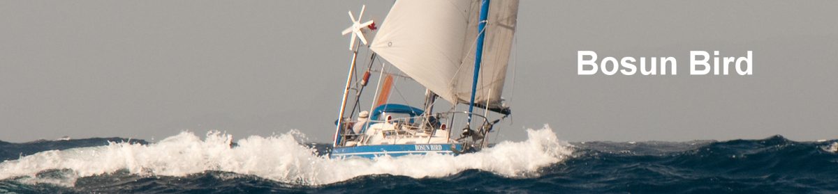
Proud of our spanking new paint job (much overdue), which included the old, sun-faded “good luck” plaques that we had obtained from a wrecked dhow many years ago on the east coast of Africa, we ventured out first into our local sailing grounds, the Gulf Islands, in mid-July. First a gentle sail, with the snow-capped peak of Mount Baker astern, to Clam Bay on Thetis island, then to Herring Bay on Ruxton Island: at this time of year, you need to put a stern line to shore, to leave room for other boats.
 Through the reversing rapids at Dodd Narrows, dead on slack-time, and we were into Northumberland Passage, approaching Nanaimo. But a strong southeasterly had picked up, so we decided to carry on up the coast. The crew, ever alert to COVID, spotted the hailing port of a large power vessel that left us rolling in his wake: “Anacortes, Washington.” He was definitely not supposed to be here at all, but the Coastguard, the Canadian Border Services Agency and the RCMP, after passing the buck between themselves for some time, in the end disavowed any interest or responsibility – an odd attitude given the resources they are evidently deploying in policing the maritime border a little further south.
 With the wind at 20 to 25 knots from the SE, we spent a comfortable night at the little-frequented, but very safe and extensive Nanoose Bay; it seems to be avoided by many people because there are Navy installations at its head, but they are almost invisible and a long natural breakwater prevents any seas from entering. By next morning – as it does in these waters – the wind had switched 180 degrees, and we beat north across the Strait of Georgia, to a pair of islands that we usually hurry past on our way north: Jedediah and Lasqueti.
First anchorage was a perfect, snug harbour at Rouse Bay on Lasqueti – just enough room for two-stern-tied boats, deep and dark forest all around with a low and bare island conveniently blocking the mouth. Many years ago there apparently used to be a telephone in a box on this island – it must have been on the cable route across the Strait of Georgia to Vancouver island – but that is long gone. Cackling geese (a sub-species of the Canada Goose) fussed around, and a family of river otters busily came and went – the kits bleating plaintively whenever they got too far from their parents.


Jedediah has many small nooks, but small is the operative word – three or four we looked at were occupied, but we tied ourselves into a tiny bay off a sheer vertical rock wall that, in profile, resembled the Rock of Gibraltar – not a recognised anchorage, but the land map identified the spot as Gibraltar Bay.  A walk through tinder-dry woods of arbutus took us to the top of islands for panoramic views over the entire Strait – right down to Saturna Island, 60 miles away on the US border.
Next day took us three or four miles into Boho Bay – a safe location where you can swing free, but on this account quite popular, especially with larger power boats. On still summer evenings, the sound carries very clearly across water, so here we were able to listen to the conversation of our choice, while maintaining our own appropriate social distance.
 Around the corner and still on Lasqueti, we next dropped into Scottie Bay, which has 360-degree protection, a wharf with a large resident fishing boat, and a few liveaboards who do not looked to have moved very far in recent memory. Lasqueti still has the reputation for being the most “off grid” of all the Gulf Islands and, even though the thrill of illegal pot-smoking is now gone from all of Canada, there is still a sense of difference here (indeed, not all the locals are reputed to welcome off-islanders at all).
We spent a couple of days exploring on foot – it is only an hour’s walk along a very quiet road to the only settlement, at False Bay. Here there is a shop (actually THE shop) and the dock from which a private ferry runs over to Parksville on the Big Island. We checked out the ice creams at the shop, but made most of our purchases at a well-stocked farm-stand on the road back to Scottie Bay (as on Salt Spring, these “honesty” stands are a major outlet for small-scale produce farmers). Back at Scottie Bay, John and Kathleen, who own a house overlooking the bay, kindly invited us for a welcome glass of cold white wine – and gave the lie to the idea that the locals are inhospitable.


Another early start, again north bound – this time up the west side of sparsely inhabited Texada Island. On our right, against the rising sun, a tug with a log barge chugged slowly towards Vancouver, while on our left the sun’s rays hit the snowfields of the Comox Glacier. By afternoon, the wind picked up. We had thought of stopping in Lund but (a) the docks were full, we learned by radio and (b) the winds were holding so it seemed sensible to carry on. Quite oddly, the wind fell from 18/20 knots to a flat calm, right at the spectacular entrance to Desolation Sound.


It was George Vancouver who gave this inlet its grim name in the summer of 1792: “there was not a single prospect that was pleasing to the eye,” he wrote. He was no doubt jaundiced because he would soon discover – once again – that this was NOT the much hoped-for entrance to the Northwest Passage. Historians now think he was actually ill for much of the voyage, so perhaps he was having a particularly “off” day.  Anyway, however many times you have seen it, the panorama once you round Sarah Point and turn east is breath-taking – sheer, high mountains all around, many in fantastic shapes, and a great expanse of sparkling blue calm water.
 We’d already seen sufficient boats around to convince us that the popular anchorages at Prideaux Haven would be as full as they always are at this time of year, so we spent a few days instead exploring Malaspina Inlet – a hard right once you are past Sarah Point.
At the Cochrane Islands we had a deep but safe anchorage all to ourselves, and spent a couple of days rowing around and exploring the eponymous islands. A colony of harbour seals inhabited a large rock at the north end of the bay and kept us entertained with their mournful calling. It was a time of big tides, and all manner of colourful creations appeared in the shallows at low tide – the starfish have apparently made a massive comeback over the years. On shore, a short walk through the woods takes you up to the Sunshine Coast Trail, which runs both north and south; a 1.5 hour walk to the south took us to Wednesday Lake, and a shorter walk the other way to a campers’ cabin under construction.


Venturing further into Malaspina, we wound our way through a tight set of narrows into Theodosia Inlet. Although this was logged forty or fifty years ago, the shores have grown back and the place has a wild, lonely feel.  A logging road provides good access to the interior, and good blackberry-picking; there was much “evidence” of bears (scat) but we made appropriate noises and had no undesirable encounters.
  An intriguing example of industrial archaeology was an old logging truck door that was somehow impaled on a very substantial tree branch, fifteen feet above ground level.
Heading back up Malaspina, we anchored in the next bay north of Cochrane: Parker Harbour. It seems an infallible rule that once you have found a nice, spacious anchorage, someone else very quickly turns up and anchors far too close. This occurred here: after the boat in question had twice come within a few feet of us, we ostentatiously put out fenders on both sides and sat in the cockpit staring at the intruder. This seemed to do the trick: shamefacedly, he moved away.
Next day we left Desolation and ran in a good following wind all the way down to Sturt Bay, back on Texada Island. This small “nick” in the coastline has a surprisingly large set of floats inside its harbour wall, and room for five or six boats at anchor. Rather than risk more wayward anchor-companions, we tied up for a couple of days. The island is essentially a huge limestone quarry and has been for many years, but it is more scenic than one might imagine: most of the older quarries have grown over by now. We breakfasted out at Mary Mary, had a dinner – we were the sole guests – at the Texada Inn – and took a long walk to the north end of the island and Blubber Bay. This unromantically-named location was once a whaling station but is now a loading station for Dolomite (a variety of limestone); there is a single very dilapidated dock, but the bay is open to the NW, so this is far from an all-weather location.


More good winds had us rolling to the southeast in Malaspina Strait (not to be confused with Malaspina Inlet) and taking a left turn into Jervis Inlet, which runs deep into the Coastal Range.  We knew the next day would be a long run, so we aimed for an anchorage well into the Inlet: Dark Cove, so named on account of the steep rock walls on all sides that block all but the very early morning sun. Vancouver may have spent a night here, after sending his longboats – vainly, again – to the head of the Inlet in search of the Passage.
 In summer, the almost invariable pattern is that the wind blows strongly up-inlet during the day, then goes calm or blows very lightly down-inlet at night; in winter the reverse applies. Even though the 40-mile long, steep-sided inlet makes several ninety-degree turns, the wind finds its way around those bends, with only the slightest of lees at the turning points. Vancouver’s longboats (after another futile search) apparently had a very tough row down-inlet: 17 hours into what their captain described as a full gale.
The inlet behaved as predicted next day, with the winds reaching well over twenty knots by noon. This made for fine downwind sailing but caused us some anxiety as we looked over our shoulders at the whitecaps and contemplated the eventual return trip.
 We raced past wide Vancouver Bay, where Vancouver overnighted on June 17 1792. Here a century ago, M. Wylie Blanchet, cruising on the Caprice with her small children, saw what she initially surmised to be a tall clergyman approaching her children, who were playing on the beach. Only when she looked again, a few minutes later, did she realise it was a large black bear. After Vancouver Bay comes Deserted Bay. This was named by white men some time in the 19th century. Approaching a native village, they saw canoes drawn up, but no smoke.
  Venturing ashore, they found the houses full of dead bodies, the victims of smallpox. Only a tiny child was still alive; she was adopted and recovered. Neither Deserted nor Vancouver are anything but fine-weather anchorages, and both suffer from very sharp drop-offs at their head, making anchoring difficult.
Turning into Queens Reach, we read in the Pilot that this stretch is “noted for its lack of wind”. Indeed, some 35 years ago, when we were here on our earlier boat Tarka the Otter and waiting for slack water at Malibu Rapids, I had rowed around and taken pictures of Tarka with her mainsail up, in a flat calm. Now the wind was 25 knots, with short, building seas. Fortunately, however, the timing was right for an immediate passage of the very narrow Malibu Rapids (which runs up to 9 knots), into the flat calm of Princess Louisa Inlet.


The Christian summer camp that is normally a hive of activity in summer was deathly quiet on account of COVID – closed, in fact. And as we motored in still, emerald-green waters the four miles to the head of the inlet, we were relieved to see that here, at least, we had escaped the madding crowds.
 For the next three days there were never more than two or three boats on the single long BC Parks float that can accommodate up to 25 vessels, and there were in addition five mooring buoys – placed in 100m of water (it is very difficult to anchor here – so sheer is the underwater profile of the cliffs). These allowed for a pleasing degree of Social Distancing..
 Many people have written of this spectacular location, with its great grey granite cliffs on all sides, and indeed in our experience it is rivalled only by Prince William Sound in Alaska. We repeated the steep walk we had made half a lifetime ago, up to the old trapper’s cabin – all that has changed is that there is a stern notice warning that the walk is dangerous and exhausting, but we were pleased to find we could complete it within the statutory time, several decades on. After a couple of days at the head of the inlet, we retreated half-way back, to another mooring buoy, at the MacDonald Islands – and had this beautiful location all to ourselves.


The return down Jervis was not as hard going as we had feared – maybe 15 knots of wind on the nose, and only for a couple of hours; the channel is too narrow to make tacking under sail a realistic option.  After another night at Dark, then we wound our way through Agamemnon Channel (all these locations were named in the mid-19th century, after great British naval personalities and ships – HMS Agamemnon was Nelson’s first command) to Pender Harbour.
 Pender is a very secure location, but is hardly wilderness – multimillion-dollar mansions line its many nooks and coves. From Pender, we had a very calm crossing of the Strait, back to Nanaimo, and the popular Protection Island anchorage; it is always a pleasure to explore the miles of paths on heavily wooded Newcastle Island.
After a calm, quiet night at North Bay, on Thetis island, we were back in Ganges a month after we had left. It had been a pleasure to explore local waters in good, sunny weather – for a change – but we’ve come to prefer isolation, so next summer we’ll either go further afield – or later.
More: Summer of the Engine