
Early one August morning, our mooring lines rigid with ice, we finally cast off from the Micalvi; the rising sun briefly turned the jagged mountains above us bright orange. Day by day, sometimes making only half a dozen miles before the weather forced us into shelter, and often pausing for days on end as gales blew past, we worked our way westwards up the Beagle Channel. It is difficult adequately to describe the Beagle Channel. The further west you sail, the wilder it is. There is scarcely a sign of human habitation once Ushuaia is left to starboard.
We spent days wind bound at an abandoned estancia called Yendegaia, just past the white stone marker on the Beagle’s north shore that marked the international border. A shy guanaco eyed us from the shore and fierce Caracaras squawked as we explored the collapsed woolsheds of the old farm.


") But hardy fisherman work these waters year-round; at Caleta Olla, at the eastern end of the Beagle’s northwestern arm, they rowed over and offered us as much centolla (king crab) as we could eat.
But hardy fisherman work these waters year-round; at Caleta Olla, at the eastern end of the Beagle’s northwestern arm, they rowed over and offered us as much centolla (king crab) as we could eat.
Then you are in glacier alley. All along the north shore, great walls of blue-white ice drop to the level of the grey-black channel, their source often lost in the grey overcast. Somewhere up in those clouds was the peak of Monte Darwin, second-highest on Tierra del Fuego; we saw it once from the air, when flying by Twin Otter to Punta Arenas, but never from sea-level.. At Seno Pia we crept over a 2 metre deep shelf (a sunken moraine) and made for Caleta Beaulieu, but the inlet was choked with large pieces of ice that moved back and forth with the tide. On the south shore we spent days tied up in snug Caleta Julia, four lines to shore and an anchor down, as rachas heeled us over to one side and the other; tramping over the peaty hills one foggy morning, we were startled by the whoosh of a pair of Andean condors.
It wasn’t all wind and waves. In Canal O’Brien the water was black and utterly still. By now, as we moved closer to the western tip of Tierra del Fuego and the full force of the gales of the Southern Ocean, the vegetation was becoming more sparse, the predominant colours the grey of smooth granite and the russet yellow of grass that spends much of the year under snow.


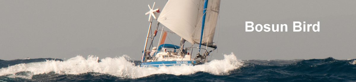
Beagle Channel


 Our first major test was the Brecknock Peninsula, the far western tip of Tierra del Fuego. This is about as wild a place as can be: gloomy and almost bare granite mountains perpetually snow capped, their lower slopes exposed to the full fury of the greybeards of the ocean; a few dwarf shrubs cling to the lower slopes but they all point east like flags in a stiff breeze, blown that way by the perpetual westerly winds; the nearest human settlements are a one-family Chilean naval outpost at Timbales, 140 miles east, and Fairway Lighthouse, 150 miles northwest. Here, tied to the shore in a spider’s web of nylon lines in an imposing rock cirque like something from Lord of the Rings, we first experienced the full extent of the worst weather in the world, hitherto only imagined from the cosiness of armchairs.
 For nine days gale and storm-force gusts of wind whipped at us from all directions, rocking us one way then another, making our rigging howl and our mooring lines strain; in the bay, only metres away from our bows, the water was whipped into a white frenzy, and the crackly Navy forecast gloomily warned of seas of 14 metres in Brecknock Channel. The pressure descended unimaginably. One day they were recording 934 millibars two hundred miles south (960 is as low as it ever gets in the northern hemisphere) and a boat in Ushuaia reported that his barometer was reading “G” (the needle was on the G in “Made in Germany”….). The weather map showed two heavy arrows (one is fifty knots). We played Scrabble endlessly, read Dostoyesky (slowly), and ventured out occasionally to clear snow off the decks, to check the lines or to make brief forays up the mountain, before the snow and sleet closed in again.
But when the storm was finally past it was a day we will long remember: first the snow falling noiselessly onto utterly still black waters then, as the sky cleared and we nosed our way out briefly into the open Pacific before scuttling back into the security of Cockburn Channel, the full splendour of the Darwin Range rising dazzlingly white out of what was now a deep blue, sparkling sea; climbers have spent months here and never actually seen these mountains, so unusual is fine weather like this.
 Sailing Patagonia also means re-learning your anchoring techniques. Sheer rock walls all around the boat do not, contrary to what you might think, spell quiet, windless anchorages. Quite the contrary: they are likely to be havens for williwaws or, as they are known in Spanish, rachas: extremely powerful gusts of short duration and unpredictable direction unique to this part of the world, they are capable of coming down vertical rock faces, creating visible depressions in the surface of the water then bouncing back upwards. The trick is to find a rock wall or a barrier of trees between you and the wind (but check to see if the trees are healthy and vertical: if stunted and bent it means this is likely a bad place) then, having dropped the anchor, reverse into the wall and the wind as close as you dare.
  Next you must row at least two lines ashore to hold the boat’s stern tight in, preferably four; the idea is that if you can edge in close enough the worst of the williwaws will pass you by at the level of your mast-top. But getting that initial line secured is easier said than done: first we would need to pump up and launch our dinghy on deck and while under way, which effectively blocked the captain’s view of where we were going for minutes at a time. Once we were anchored stern to the wind, Jenny would hurriedly climb in, with one 100m line attached to her waist, another in a bag; while I held the boat in full reverse, she would row hurriedly to shore, identify a suitable tree, boulder or shrub, secure the dinghy, climb out and tie the line on; then at leisure she would find a second point, tie on again and row the second line back. There would meanwhile be much shouting and gesticulating back and forth, usually as the captain decided that the tree or shrub selected by the crew was not in the right place after all and/or the lines weren’t long enough…..At night, before going to bed, we would both separately check the anchor, lines and depth under the keel, and twice again during the night; on top of this, we would set the alarm on the GPS to go off if we budged more than a few feet.
 The fierce and usually contrary winds, plus the daily need for intricate manoeuvering as above meant that we needed to give our trusty diesel engine extra loving care and attention: at least half the distance covered on this voyage was under power, and most boats power 90% or all the way. So another daily post-arrival ritual would be to take the engine cover off and spend at least twenty minutes giving it a once-over, checking everything from the oil level to belt tension. Every so often, we would also need to top up the main fuel tank from one of the ten additional 20 litre jugs we were carrying just or this purpose. The final task for the day would be to get the charts out (we were carrying about 200, often getting through two a day) and go over the options for the next day: distance and route to be covered, ideal destination and several back-up destinations. Whatever we planned was still, however, subject to the Navy weather forecast at 20:30 every night and our own computer-generated models, which we would usually download by satellite phone first thing in the morning.
 From Cockburn Channel, which runs E-W, we turned off to the north, to enter a narrow and especially intricate passage called Canal Acwalisnan. The tides run fast though here and we needed to time our passage to within a few minutes, or find ourselves swept around, out of control, by an eight knot current. As we emerged, we could see to the north even higher mountains: we were now looking directly at the continent of South America again, last seen many months earlier when we had left Puerto Deseado on a grey evening.
 We edged out into the famous Strait of Magellan and turned to the NW. Astern we could see the grey, snow capped cliff of Cape Froward, the southernmost tip of the continent. It wasn’t the Horn, but it looked forbidding enough.
More: Chilean Channels