
 When Mark Twain said that he had never spent a winter as cold as summer in San Francisco, he could just as well have been talking about Puerto Montt, where we spent much of the austral summer of 2006/7, tied up at a tiny marina.
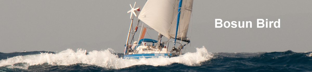
Chistmas Eve was celebrated with 17 people on board the 8 metre Bosun Bird, but Christmas Day was more commodious: a potluck affair at the marina’s internet room (two computer terminals, a book swap and an overstuffed thee-piece suite).  The attractions of Puerto Montt are modest. Many cruise ships call in summer but the passengers come for the spectacular mountain hinterland rather than the night life or sophistication that they might find in Valparaiso: the port area is rough and ready, with seedy clubs with names like “Pasiones” or “Lady Nigth” interspersed with shops selling chain and outboard engines. At night you stand a good chance of stumbling over recumbent fishermen recovering from a three-day binge on which they have likely spent the proceeds of a month at sea. But the supermarkets are dazzling after the three dark corner stores that had sustained us over winter in Puerto Williams and there is even a multiplex movie theatre.
 After so much time cooped up in the tiny confines of Bosun Bird, we got back into shape, first, by spending a week hiking on the west coast of the big island of Chiloe: endless beaches, pounding surf, rain and some rather truculent Huilliche indians; it was not much changed since Darwin rode out here and wrote: “I was assured that after a heavy gale the roar of the surf on this beach can be heard at Castro, a distance of no less than 21 sea miles across a hilly and wooded country”. Darwin commented that the Huilliches were “humble to a degree which it was quite painful to witness”; things have changed in this regard, at least; one very corpulent lady on horseback threatened Nick with a birch switch when he declined to pay her for having photographed her at a distance of more than 100 metres.
 We explored the waterfalls and lake shore at Petrohue, now part of the Che Tail, to which you can buy guidebooks and maps (the route followed by the young Che Guevara and Alberto Granados with their motorbike in the fifties, now a cult movie hit). Most enjoyably we rented a car and drove 200 km north to the foothills of the Fuji-like Villarica volcano to put faces to two names that had become familiar to us over the past year: Wolfgang and Gabi, who run the Patagonian Cruisers’ radio net and who, having sold Wilde Mathilde, their own boat, now have a farm here in the mountains. As well as the usual sheep and chickens they have a few alpaca (a kind of llama) and a luxurious guesthouse; from the bedroom, through the picture window, you can at night see the rim of Villarica glowing red.
 By February, with the short summer drawing in and like birds preparing to migrate, most of the boats in the marina were getting ready to head out into the open Pacific again. We began once more the ritual of studying weather maps, waiting for the Pacific High to position itself in such a way that we would have a good ride north up its eastern edge and then be able to work northwest and west, once past latitude 35 South. Complicating the departure scenario was the need to transit the narrow Canal del Chacao, a natural strait between the big island of Chiloe and the mainland, in the daytime, with a favourable tide and no opposing wind: the current here, like in the tidal narrows of British Columbia, runs at up to ten knots and can create very dangerous conditions (waves of 10 metres) as and when a strong wind opposes it.
As it turned out we sped though Chacao in perfect conditions, passing the appropriately named Roca Remolinos (Whirlpool Rock) at a speed over the bottom of nearly fourteen knots and emerging into the Pacific on a bright sunny afternoon on March 2nd. Over the next 24 hours, the wind picked up to gale force but fortunately it was coming from astern, and we made our best day’s run ever: 135 nautical miles in 24 hours. Ten or twenty miles ahead of us, the larger Dreamaway was knocked down and sustained some damage, but the worst we experienced was some (very cold) slop into the cockpit. The crew stumbled around while trying to cook and annoyingly bent the engine ignition key while falling and spilling hot coffee everywhere but after the wind settled down, we too settled into our almost-forgotten offshore routine of 3-hour night watches. Fortunately, our course soon took us away from the ironbound shoreline and, as we exited the Roaring Forties for the first time in over a year, we saw only two ships, from a distance. A week and six hundred miles out from Puerto Montt, under a full moon, we sighted the rugged cliffs of the eastern point of Robinson Crusoe Island.
 This remote Chilean possession is one of three islands that make up the Juan Fernandez archipelago and is the only one that is permanently inhabited, by about 500 people. It owes its name to the experiences of Scottish sailor Alexander Selkirk who was put ashore here, after a dispute with his captain, from the privateer Cinque Ports in 1704; the four years and four months that he subsequently passed here alone (with no Man Friday) formed the basis for Daniel Defoe’s famous novel. When Selkirk was picked up again by Captain Woodes Rogers, the latter noted in his log that he was “clothed in goat skins…and looked wilder than the first owners of them.” The island once again came to international attention in 1915 when, after an epic chase through the channels and islands of Patagonia, a British naval squadron intercepted a radio message from the German battle cruiser Dresden, the sole German survivor from the Battle of the Falklands, and tracked her down to Robinson Crusoe, where she was anxiously awaiting a coaling vessel in Cumberland Bay. A few shots were exchanged and, after a brief parlay led by a young German officer called Wilhelm Canaris (later the head of German espionage in WW2), Captain Ludecke scuttled his vessel. More recently the island has occasionally made the news as an American treasure hunter determinedly digs on for what he claims is 800 tons of treasure supposedly buried here in 1713 by the Spanish.
 The little village of San Juan Bautista clings to a narrow strip of shoreline around Cumberland Bay, with the 900-metre cloud-covered peak of El Yunque (The Anvil) towering over it. There are three or four small shops that reputedly stock fresh vegetables for a few hours after the supply ship comes in, but the last visit had been some time ago, and all we could find were some tired onions and potatoes. At the Casa de Cultura we were pleasantly surprised to find free internet access: even Chile’s remotest communities seem now to be “connected” (which is more than can be said for the supposedly much more prosperous, French-administered islands of Polynesia). The island has only 1500 metres of motorable dirt track (the airstrip is reached by a sometimes perilous two-hour journey by open boat), the length of the village, but there are at least a dozen motor vehicles even so.
 We went for a number of long walks in the steep and wooded hills behind the bay, notably to the so-called Selkirk’s Lookout, to which Alexander Selkirk supposedly made daily visits in the hope of sighting a ship (he must have been very fit after a few weeks of this). Another hike through eucalyptus woods took us to a long-abandoned farmhouse where a survivor of the Dresden had homesteaded for many years until, in the 40’s he was denounced as a German “spy”. Much of the local wildlife is endemic, including the very rare Juan Fernandez hummingbird, of which about 250 specimens survive.
 Our next ocean passage was much longer: 1650 miles in a straight line to Easter Island, but we knew we would have to do at least 1800 as we manoeuvered north of the calms in the centre of the Pacific High (friends on Dana, a week or so ahead of us, had tried to go direct but reported to us by radio, thee days running, that they were completely becalmed).
After a few days during which we averaged only 70 miles or so in a northwesterly direction, we at last started to pick up the tradewinds and were able to set our course nearly due west for this easternmost island of Polynesia that is also the remotest inhabited location on earth, and our average improved to 100 or better.  Day after day the wind blew from dead astern as we ran with the mainsail hauled out to one side, our small staysail poled to the other. Being small, heavy and round-bottomed Bosun Bird rolls some thirty degrees to either side in this mode; the good news is that the constant bracing that you need to hold on keeps you as fit in this tiny space as a good brisk walk might; the bad news is that it’s difficult to sleep when you risk falling out of your bunk every few minutes. . Most nights three or four flying fish would thud into or side or our sails (they seem to be able to see us and avoid us in daylight…) and, in spite of the emptiness of this part of the planet – we saw no ships – there were seabirds with us nearly every day, including on occasion pairs of Bosun Birds.
 Mid-morning on April 2nd, after eighteen days, we sighted Cape Roggeveen, the easternmost tip of the island. We were now faced with something of a quandary: the wind had come round into the north and was likely to clock further, to the northwest: from either of these two directions, the notoriously poor main anchorage, off the only settlement at Hanga Roa, would be exposed. Accordingly, we decided to anchor for the time being at a more remote cove on the south coast called Hanga Hotu Iti, and wait for better conditions.
This is a spectacular location: 150m-high black cliffs to the north and, at the head of the surf-bound bay, a line of fifteen enormous moai: the gigantic and enigmatic stone monoliths for which Easter Island is so famous. Unfortunately, it’s not a great anchorage, even when the wind is in the north. The next morning a fisherman came over to us in his panga and advised us to move a little further out. We soon found out one of the reasons why: our anchor was virtually jammed on the coral bottom; it took the crew an hour and much exertion to get it up, and in so doing we bent one of its three flukes. Still, when we reported in by radio to the Chilean navy base in Hanga Roa, the friendly young rating advised us that in the present weather we were better off staying where we were than coming around to their side of the island.
Next day the surf and wind were down and we made the one-mile row to the tiny nook on one shore that Victor, the fisherman, recommended we use for landing. The fifteen moai that, with pouting lips and hands folded over their abdomens, preside over Hou Iti are impressive enough, but only a thirty minute walk away is perhaps the highlight of the island: the quarry or “nursery” from which all of the moai come and where more than 100 can now be seen in all stages of carving, from bare outlines in the living rock to partly buried specimens with only the head showing.
 There are almost as many theories about these monoliths and, indeed, the origins of the native people of Rapa Nui – as the islanders prefer Easter Island to be called – as there are statues. Thor Heyerdahl’s theory that Easter was colonised from the South American mainland is now discredited and a consensus seems to have emerged that the first inhabitants arrived from the Marquesas, 1500 miles to the northwest, in about 450 AD. But why the moai were carved and how they were moved is still unknown; when the first Europeans arrived, almost all the statues had long been toppled and no-one could remember their meaning, or decipher the glyphs that then could still to be found on wooden tablets (“Rongo rongos”) in some homes.
Seeing the moai in situ was one of those rare travel experiences that lives up to the advance hype. The scale, the enigmatic look and posture of the monoliths and the sense of sudden, unexplained abandonment at the quarry contribute to this, but there is also the broader setting: the knowledge that the nearest speck of land is 1100 miles away and that for centuries the people who made these statues must have lived as by far the most isolated humans on the planet.
 Next day Victor picked us up in his powerful launch and, with his wife we made a quick run by car to Hanga Roa, the only settlement. This is a buzzing little place with a couple of good supermarkets, where we hurriedly restocked on fruit and vegetables, and we also filled up jugs with another 40 litres of water – a precious resource here, where there is no ground water at all. Rolling out at anchor we could see old friends from two other boats (Dana and Tom Bowling) but between us and them were two parallel rows of surf, so we had no regrets about not moving here. And the tiny fishing harbour at nearby Hanga Piko, where boats as small as ours are sometimes allowed in, albeit with a pilot, was effectively sealed off by a mass of seething white water; the two sailboats already in there were trapped and were rolling heavily into each other.
 Back at Hotu Iti, by the time we got back the surf had risen dramatically, with 5-metre combers now breaking across the entire bay. From land Bosun Bird all but disappeared from view every fifteen or twenty seconds as she rose and fell between crests and troughs. Victor knew how to time the breakers and he skillfully ran us out through the surf: in our own little dinghy, even with a powerful outboard, we would have had no chance. Most alarming was the fact that even though the breakers were so high there was almost no wind to keep us offshore: each massive swell brought us surging forwards and upwards and it seemed that in every trough we were left a little closer to the point where thundering spray rose from the breaking crests.
 In the late afternoon sun we hastily hauled the anchor up and motored out into the gloom. Barely had Easter Island receded from view than we ran into a vigorous low: 36 hours of non-stop torrential rain, coupled with strong winds from the North. However this did serve to put some miles under our belt, which was just as well because thereafter the wind virtually died for two weeks. Day after day we would ghost along at one knot, getting excited when we crept up to two, the sails slatting heavily, the surface of the sea oily calm. Several days we went swimming over the side: a strangely uneasy feeling so far from land and in water 4 kilometres deep.
  And speaking of uneasiness, one day, Jenny had just got out and was drying off in the sun when Nick spotted a disturbance in the water just astern: it was a 12ft shark, no doubt attracted by her thrashing around. Another day, a school of False Killer Whales came visiting: from below you could clearly hear them singing to each other. Most days we had visits from seabirds of some sort: large Masked Boobies, twittering Bosun Birds and, as we moved further west, graceful Tahiti Petrels.
Out in these expanses of barely-travelled ocean, we were seeing the world as it has been for millenia, and as it presumably will be for millenia to come: there can be few other environments on earth so untouched. The nights were clear, the stars starling in their sharpness; each night we would both have six hours alone to contemplate the stars and the slowly growing moon. As for UFO’s, we did see shooting stars so bright that you almost expected to hear the ocean hiss as they plunged down; and one night a bright white and red light moving west at a speed of at least five hundred knots; but it was almost certainly the weekly Santiago to Tahiti service of LanChile…
 1100 miles out we drifted – for two days – past lonely Pitcairn Island, a British dependency. This was the final refuge of the mutineers of HMS Bounty once Fletcher Christian had taken command, put the dour Captain Bligh into his longboat with a few faithful followers and taken on a much better-looking and more amusing shipload of young Tahitian damsels. Christian chose Pitcairn because it was well off all usual shipping routes, its location charted only uncertainly, and known to have no all-weather anchorage: it was thus an excellent place to hide from any pursuit that the Admiralty might eventually mount. But the fun soon stopped: in the ensuing years most of the mutineers killed each other. The recent history of the island has not been much happier: over half of the adult male population (total pop 40, nearly all with the names Christian or Adams) has recently been found guilty of indulging in years of sexual molestation of the island’s few girl children and have been sentenced to prison. A jail has had to be built, supervisory staff sent in and – as might be expected – morale in the community is at an all time low.
Although the winds were light there was a very heavy swell running – a reminder that it was winter now in the Southern Ocean – and we were not inclined to repeat our experiences of Easter Island in the even more marginal Bounty Bay; it was with some regret that we sailed on.
 23 days out from Easter, the archipelago of the Gambier Islands, the easternmost outliers of French Polynesia, hove into view: some ten small but high and lush islands all within a large diamond-shaped encircling reef, with three wide entrance passes. Although the Gambiers are now more connected to “civilisation” than Pitcairn (which has no airstrip) this is quite a recent development; communications for much of the twentieth century were so sporadic that that the islanders learned of both the outbreak of WW1 and of its culmination on the same day (“I have good news and bad news…which would you like to hear first?”)
 The only significant settlement is the village of Rikitea, with about 500 people, on the largest island: Mangareva. We anchored off a long, dilapidated shed that, we soon learned, had an interesting past: for a period of about twenty years this was a fallout shelter, into which French officials would herd the entire population when they were conducting atmospheric atomic bomb tests at the atolls of Mururoa and Fangataufa, about 130 miles to the west. By the nineties the tests had gone undergound, and the programme has now been entirely abandoned in favour of electronic simulations, but the period is remembered with some bitterness by the locals; the island’s one and only “restaurant” (only open once in the three weeks we stayed) is called “Pizzatomic” and has as its logo an outline of the island with a fiery red cloud rising behind it
We checked in with the gendarmerie and were then free to see the sights of Rikitea: twenty or thirty single-storey houses spread along a shady track by the water, each with an incredibly lush garden crammed with exotic tropical plans, from bouganvillea to trees with enormous grapefruits and breadfruit dangling. There are two or three shops, all run by wizened and uncommunicative old Chinese men: they say in these parts that the Polynesians own the land, the Chinese the businesses and the French the power. To our disappointment, the boulangerie was now defunct; one of the Chinese occasionally baked bread but, just after we had become accustomed, he told us that there was no more flour, so there wouldn’t be any more bread until the next ship came in, three weeks hence. The only alternative was deep-frozen sliced white bread from New Zealand at USD $7 a loaf. What was equally frustrating: although exotic fruits of all sorts grow in abundance here, everyone has such copious supplies that there is none for sale to outsiders.
 The only industry here is pearl cultivation: specks of mother-of-pearl are carefully grafted inside oyster shells and then left to grow in cages suspended on ropes from buoys, or hung into the water from the floor of houses on stilts, which dot the lagoon. A top quality black pearl – and the Gambiers are apparently one of the best places in the world for them – can fetch upwards of USD $1000, so we were not too seriously in the market. As is (surprisingly) the case in many of the lagoons, there is no fishing to speak of: almost all of the species that can be caught within the lagoon suffer from ciguatera, a cumulative toxin that can be extremely dangerous, even fatal, to humans; while the locals tend to blame this on the years of nuclear testing, the case is far from proven and the phenomenon occurs in waters far more distant than this from Muuroa.
 We spent several days cruising around some of the smaller islands. Nearly all of these are now uninhabited but all have absolutely monumental churches and associated buildings that seem quite out of place in a location so remote and with such a modest population; the main church in Rikitea is about the size of the average cathedral. All date from one dark period: 1830 to about 1870. During this time Catholic missionaries under one Pere Honore Laval established in the Gambiers what can only be called a religious gulag, a theocracy with strict rules of clothing, social and moral behaviour, and the entire Polynesian population (initially about 5000, but it soon fell to less than 2000) working on church-run labour schemes (including the construction of those colossal churches); the entire marriageable female population was permanently confined to an enormous convent, the ruins of which can still be explored.
The island of Aukena was typical. We anchored off an idyllic palm-backed sandy beach in 5 metres of bright blue sandy-bottomed warm water, careful to avoid the numerous coral heads that are not only unfriendly to fiberglass hulls but around which, if you are not careful, your anchor chain can wind itself inextricably as the wind shifts and you boat wanders around. On shore we found an old well, a complex of now roofless buildings with full-sized trees growing inside them and – quite invisible from seawards so dense is the surrounding vegetation – a white-painted and red-roofed church, firmly locked with a new padlock; although some of these churches have not been used in a hundred years their rooves and walls are still maintained.
Back at the main anchorage there were a couple of boats we knew from Chile: the French Ch’t’imagine (normally known to the anglophones as Shitty Machine) and Breakpoint from Germany, with the much more serious Tom and Tatiana on board. There were several new arrivals – mainly Germans – from Panama and the Galapagos, including a multimillion-dollar professionally crewed mega-yacht from the UK called Impression; when Impression’s owner flew in for a week’s stay, he kindly hosted everyone to a rather posh cocktail party on board, with the uniformed crew serving drinks and canapes from silver trays; rather reminiscent of diplomatic dos, except the guests were generally in ragged tee-shirts and shorts and the talk all of weather, engines and autopilots.
With nearly 20 boats now in (more than we had seen in total over the previous two years), the Gambiers were starting to seem crowded, and one day we even had to move when an American yacht anchored too close to us (the etiquette is that he should have moved, not us, but it’s usually easier to do it yourself and let the other guy then feel embarrassed….). So after a three week stay we moved on, still heading almost due west.
 A day or so out we passed Mururoa and Fangataufa on our right: last time we sailed the South Pacific, in the 1980’s, you couldn’t get within 500 miles of the test zone but now only the two atolls themselves are off-limits, with a skeleton (no pun intended…) crew of the French navy monitoring the “hot spots” on the atoll’s perimeter. A couple more days out, a terminal on Bosun Bird’s inner forestay (one of the steel cables that support the mast) failed; this was not critical but it did mean that we could not set the sails exactly as we wished, which in turn slowed us down a little. Accordingly, it was nine days before we had covered the 700 miles that separated us from Raivavae, one of the islands that make up the widely-scattered Austral group, to the southeast of the big island of Tahiti.
Raivavae was quiet in the extreme, the more so in that we were the only visitors over a two-week span. We were excited to learn that here, at least, there was a proper boulanger, and that he did a circular tour of the island between seven and eight every morning in his little white van. He was not quite that reliable, of course – one of they island’s six French
 The two-person delegation at the Gendarmerie were exceptionally welcoming and friendly: they gave us maps, had us round for coffee several times, lent us their bikes for a circuit of the island, and spent a morning on board. They also asked us to sign the island’s Livre d’Or (a kind of logbook for all visitors); the first entry was in the fifties – the arrival by schooner of a new French administrator – and there had only been five or six yachts a year over the past few years; the book was scarcely one third full.
 Another expat whom we got to know was the 69-year old Edmond, owner of the island’s only vegetable patch (Polynesians have no time for vegetables, it seems, preferring taro – and just taro – three meals a day; the vahines are no longer as slim as they were in Christian’s day). Among his banana trees and tomato plants he had over the past eight years built himself a small wooden sailboat and professed that any day now he would launch it and set off on his long-dreamed about voyage around the world: did we advise him to go via the Straits of Magellan or the Horn? What about his wife, we asked? “She doesn’t want to know anything about it..”, he said. Much later, we learned – sadly – that Edmond’s boat was wrecked in the process of launching, and his dream was brutally ended.
 For part of our stay we sailed out to one of the motus (small encircling islets) on the reef that all but encircles the big, high island. Navigation across these lagoons is all by eyeball: the water is typically very shallow and studded with coral heads: having the sun high and behind you is vital as you gauge the darkness of the rocky patches and the degree of blueness of the water. Once moored (with two anchors down, to keep us from swinging onto coral outcrops as the wind shifted) we were in a classic South Seas location: two miles or so of deserted white sand beach before us, coconut palms waving in the trade winds, the waves crashing onto the exposed outer reef as we lay in still clear water. Beach-combing on the reef we found all sorts of flotsam: Coke bottles from Chile, yoghourt containers from Panama, fish crates from Australia and New Zealand, and even the wreckage of a fiberglass dinghy (complete with name and phone number, but no area code).
It was now June and mid-winter: some nights the temperature dipped below 20 degrees. So we were off again: this time 370 miles, almost due North towards the sun, to the Big Island, cosmopolitan Tahiti. We had an unplanned encounter with a piece of coral in the entrance pass, but otherwise this was another quiet passage – allowing us to brace for the bright lights and hurly-burly of Papeete (there was even wi-fi in our anchorage, which says it all).


More: Tahiti to New Zealand