For supplementary details, including GPS coordinates, see Solomon Islands for Cruisers.

 It was just an overnight sail from the Torres Islands, at the northern tip of Vanuatu, to the first of the Solomons: Vanikolo, in Temotu province. We worked our way through a narrow passage named after an Irish pirate – Dillon – to a lake-like anchorage surrounded by high peaks, with mangroves ringing the water’s edge.
Although we had only come 100 miles and were still in Melanesia, it was soon obvious we were in a new land. The dugouts here were single-hull, not the Polynesian-inspired outriggers of Vanuatu; and when their paddlers opened their mouth, they were stained red as if by blood – betel nut, not kava, is the narcotic of preference in the Solomons. The people were also noticeably less shy; within minutes of our anchoring, dugouts were heading for us from the nearest village, some three or four miles away; the locals were friendly and wanted only to trade, but three or four hours of constant visits, with canoes lining up to talk to you, while others knock against the hull and chip away at the paint work, can be trying.
The Pacific-wide concept of Island Time was, however, just the same. One of the many locals with whom we chatted was a policeman who was home on leave from his station in Honiara; he had been due back two weeks earlier, but there had been no passenger ship and he had no idea when there would be; his last such “leave” (for which he was nevertheless paid…) had lasted nine months.


It was a short hop to the next island, Utupua, and another mangrove-lined and well-protected anchorage. Here, as at Vanikolo, the locals warned us not to swim. Some six or seven years earlier, a Swiss yacht had anchored in this precise location; he had dived into the water to check that his anchor was set, and his distressed wife had then watched a crocodile take and eat him. His remains are buried in the local village, where his widow has built a school in his memory. We were still far from the a bank so we did some more trading in Utupua: items we parted with included a year-old copy of The Economist, an old Vanuatu newspaper, exercise books and fish hooks, while in return we loaded on papayas, bananas, sweet potatoes, mangrove oysters and mud crabs. We also came across for the first time a kind of elongated and deformed cucumber that is known as Snake Bean; when we asked the (male) vendor how to cook snake beans he said we should slit the bean open and with care extract the white seeds – the edible part. It was weeks later that we learned we should be doing the reverse – throw away the seeds and eat the exterior; evidently men don’t do much cooking in the Solomons.
 At Temotu’s “Big Island” of Santa Cruz, 80 miles onwards, we hoped formally to clear in to the Solomons. As we walked the 6km into town from our anchorage, locals repeatedly reassured us that we would find Customs, Immigration and even an ATM. As it turned out, although there was a large and apparently new sign informing us of the opening hours of Customs and Immigration, it had been six years since an officer from either government department had been posted here; later it was suggested to us that at the time of “The Tension” (a period of near anarchy and civil war that lasted from 1999 to 2003), many government officials “bought” the government housing in which they were living at knockdown prices amounting to only a few USD and, after quitting service, have been living in their new homes ever since. Meanwhile, there was an ATM but it had been empty of cash for a year; we were able to buy a few Solomon dollars from a shop.
Remote Santa Cruz has an interesting history. When the Spaniards were exploring Peru in the early sixteenth century, one of the most pressing questions was the source of the gold used by the Incas in their fabulous ornamentation. In one of the great con-tricks of history, the conquistadors were told that it came from some islands “over the horizon”. Alvaro de Mendana was one of a number of sea-captains to take the Incas at their word; he sailed almost the entire width of the Pacific before stumbling in 1567 on Santa Cruz where, imagining that this must at least be the site of King Solomon’s mines, he gave the islands their modern name. Later he returned to found a colony here; it failed and all traces of the settlement have long since disappeared but a local suggested to us that Mendana’s influence lives on in the disproportionate number of island chiefs whose names begin with “M” (!). It is only in the last two or three decades that any gold has in fact been found – and that on Guadalcanal.
From Santa Cruz it was a full two days’ sail to the main grouping of the Solomons. We began our meander west and north at the tiny but densely populated island of Santa Ana. Here a family with a fascinating pedigree adopted us. Heinrich Kuper was a German trader who came to the Solomons at the beginning of the twentieth century. He married into tribal royalty on Santa Ana: an old black and white photo shows him in shirt and tie towering 50cm over his ornately beaded wife the day of their wedding. As two world wars came and went the family anglicised their names; son Geoffrey Kuper was a leading light among the famous Coastwatchers who clandestinely assisted allied troops from 1942 onwards; Geoffrey’s widow, daughter (Greta) and son (Henry) now live on Santa Ana. Greta pulled out piles of old [photographs from the 1940’s onwards: many showed long-forgotten traditional ceremonies on the island, and there were a few of Greta’s mother with Queen Elizabeth when she visited nearby Star Harbour in 1973.


Not quite all of the old ways have been forgotten. On the weather coast of the island there exists a well-maintained “kastom” (traditional) house that is used for ceremonies and where the remains of chiefs and elders are buried; the chiefs’ remains are placed in miniature war-canoes some 2 metres long and suspended from the rafters; the skulls and bones of elders are encased in baskets and simply piled up on a large altar. The current chief (who sadly said that he would, on account of the pressure of missionaries, have to forego a canoe) was happy to show Nick around but taboos meant that Jenny could not enter.
 From Santa Ana we coasted along the north coast of large Makira Island to anchor in the lee of Uki Ni Masi, some four or five miles offshore. A local rogue called Peter befriended us here and obtained for us all sorts of goods, fish and vegetables; we were sure he was playing truant from the secondary boarding school up the hill and was almost certainly filching the vegetables from the school’s own plot. We spent a morning chatting to the teachers at the school, which is home to about 300 students; formerly run by the Church of Melanesia (i.e. the Anglican Church) it has now been taken over by the Province and has fallen on on hard times. The chemistry teacher complained to us (understandably) how difficult it was to teach his subject with literally no budget whatsoever for chemicals or equipment. Meanwhile, across the strait we could see the forests of Makira being clear-cut by a Malaysian logging company; someone was making a lot of money here, but not much was coming back to where it was needed.
 Next to the eastern tip of Guadalcanal Island, where a maze of islands and waterways forms Marau Sound. Here we anchored close to a very plush but under-utilised resort called Tavanipupu. The local chief, Justin, explained to us that the resort was one of the few such places that had not been sacked and/or burned during the Tension, but the region still had its share of trouble. Justin and the villagers in his care are historically from the island of Malaita, and in one of its manifestations the Tension was about conflict between the people of Guadalcanal and those of Malaita. For an entire year Justin’s people had effectively been besieged on their small island while “weathercoast people” (i.e. from the big island of Guadalacanal) ran rampage with heavy weapons throughout the Sound. Other tensions still existed today: there was clearly some (still manageable) strain between the locals and the resort management, some of it predictably arising from concepts such as Island Time and what the management euphemistically called “differing work ethics”, while Justin – who is also a pastor – was keen to do down neighbours of other religious persuasions (“you can’t trust those Romans”, he insisted…).
Gudalacanal is of course infamous around the world as the scene of some of the bloodiest fighting of WW2: it was the setting for America’s first major military engagements following Pearl Harbour and the island on which the Japanese advance towards Australia and New Zealand was halted. Over 60 major warships lie on what is now called Iron Bottom Sound but Henderson Field – now Honiara International Airport – was the key. With control of it, the US could hope to step its way north and west almost to the shores of Japan; without it they would be hopelessly distant in Vanuatu, and Australia would be exposed to Japanese bombing. So it was sobering as we ghosted our way into Honiara, just as a Virgin Blue jet settled into its glide path: this was where first American landing craft had gone ashore, with next to no air cover and only short-lived support from their mother ships as word was received of a Japanese battle fleet steaming down The Slot, from Rabaul.
 Unfortunately, Honiara today is no place to linger with a yacht, even though a stop to complete formalities is obligatory. There is a friendly enough yacht club at Point Cruz but the anchorage is wide open to any winds between north and west. And the town itself is unattractive: concrete and tin shanties thrown up after WW2, and criminality rampant. Particularly unattractive is the debris left everywhere from betel-nut chewing: great puddles of red saliva that at first have you thinking you have just missed a bloodbath. Up on a once-fought-over ridge behind town is a large and well-kept American war memorial, but there are few other signs of the place’s history beyond the propeller from a Japanese Zero that is now mounted on a wall at the airport.
 As soon as we could, we moved on westwards, to Tambea on the western tip of Guadalcanal, then a long day-sail to the Russell Islands. This was once a fief of the giant Lever Brothers company: the islands were managed as one vast copra plantation and a company town was built at Yandina. In a reference to Sunlight Soap, the channel between the two main islands is known as Sunlight Channel. Lever’s left at the time of independence in 1978, when the massive holding was broken up, but times have been hard ever since: most of the copra-processing machinery was destroyed in The Tension and an industrial dispute has prevented any further resumption of commercial activities; over 1000 jobs have thus been lost.
 The most popular area for cruising is in and around the Marovo Lagoon and the adjacent island of New Georgia. We spent nearly three weeks moving from island to island, all in crystal clear and well-protected waters. Marovo is home to most of the Solomons’ wood carvers and – with judicious bargaining – some exceptionally beautiful pieces can be obtained. The most well-known carver enjoys the name John Wayne, but he has dozens of rivals. They are nearly all Seventh Day Adventists, having been converted at a stroke by a “visionary” (?) Australian trader in 1948; SDA’ers may not eat products of the sea that do not have scales, so this is a particularly good location to find lobster (SDA’ers who are not necessarily 100% devout are semi-officially known as Backsliders, we learned; they have no qualms about fishing for lobsters for others to eat…).
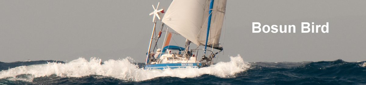
Unfortunately, as we were preparing to leave Marovo we suffered an incident that soured things: a nocturnal “intruder” whom we had to chase out of the interior of Bosun Bird’s cabin at 02:00 in the morning. We have suffered theft before – including the theft of our dinghy in “civilised” New Zealand – but this was especially unnerving; sadly – as we found out when we gathered with other yachts in Gizo – the incident was not untypical.
 From Marovo we wended our way still west, and into the shallow, complex waters of Vonavona Lagoon. There is no chart of this lagoon and the water in many places is barely 2 metres deep so you need to be on your toes and to have good sunlight behind you (so as to see looming reefs). A particularly interesting call was at Skull Island where on display, in the open, are hundreds of skulls not just of chiefs but of the head-hunting wars that bedevilled this part of the Solomons prior to the arrival of the missionaries. At Lola Resort we did lots of laundry, read about four years’ worth of New Yorkers in the resort bar and sipped cold SolBrews while Joe, the resort owner, regaled us with stories of the Solomons.
 Our destination, prior to leaving the Solomons, was Gizo – the “second city”. Just outside town, we passed a small island on the reef. Old charts call it Plum Pudding Island but the newer ones give it its popular name: Kennedy Island. One dark night in August 1943 John F. Kennedy was skippering his Motor Torpedo Boat, the PT109, in nearby Blackett Strait. He was rammed by a Japanese destroyer running at full speed and with no lights – the so-called Tokyo Express that resupplied Japanese outposts every night, from Rabaul. Kennedy and his crew swam to Plum Pudding Island and the rest, as they say, is history.
For the next six weeks we were quietly anchored in Gizo, off a waterfront bar known as….the PT109. Actually it was not so quiet, because there was a very loud disco, featuring island music, that boomed out three times a week from 21:00 to 01:00. Our plans suffered a slight delay in that the captain was afflicted with that all-too-common ailment of men in late middle-age – a hernia – and had to fly to Sydney to have it fixed, at great expense (they could have done it in Honiara for USD $125 but even the local doctors were hesitant to recommend this option).
 Meanwhile we came to know Gizo well: the Chinese shops lining the main street, the illegal card sharpers that gathered every day, cold SolBrews and fish and chips at the PT109 or the Gizo Hotel and catching up on the news via the Solomon Star. We met the one and only Canadian resident, Patrick – our “wontok” as it would be put in pidgin – and he kindly invited us to Christmas lunch with his wife Jully, who is a well-known poet. Lawrie Wickham, manager and owner of the PT109 adopted us and kept an eye on Jenny when Nick had to fly to Australia; he is Gizo aristocracy and a direct descendant of the Alec Wickham who invented the style of swimming now known as freestyle. Jenny went to a couple of walks/social events hosted by the Gizo Hash Harriers – whose slogan is “Jas Ranim, Wokim, Singim, Drinkim” (Just running, walking, singing and drinking…). Among the friends she made was Rambo, who doubled as bouncer and lounge singer at the Gizo Hotel: when called to the stage he would have to delegate his bouncing duties.
 This year, Lawrie and Patrick told us, there were more yachts in Gizo than there had been for many years: up to 13 at one time. This, they hoped, signalled an improvement in the climate for tourism: perhaps they would now start thinking about renewing the old tradition of annual yacht races from Queensland to Gizo. But they agreed with us that security remained something of a problem. An informal poll of the 13 revealed that more than half had suffered, at some point during their sojourn in the Solomons, a security “incident” – typically a nocturnal boarding and robbery (but not with violence, thankfully). By now, we hoisted our dinghy on deck every night to prevent theft, cleared the cockpit and decks of anything tempting, kept a bright light burning in the cockpit all night and slept with a can of Mortein (cockroach killer..) at hand – this last was a recommendation of Lawrie’s; a quick squirt in the face of thieves had several times proved effective and immobilised the “rascal’ long enough for the police to arrive!
 After Christmas it was time to think about leaving. We edged our way back eastwards, to Ringgi Cove and Jack’s Harbour on Kolombangara Island; some last-minute trading saw us hand over a copy of Ocean’s 11 (for villagers to watch at New Year’s) and several copies of a CD of Solomons Reggae, by Dead Man’s Project – in return for papaws, pineapples and so on. Then an overnight sail to the north, to the eastern tip of Choiseul Island (pronounced CHOY-zull). Here we spent a final night at anchor off an apparently idyllic islet; in the morning the captain spotted two medium-sized crocodiles ambling lazily along the beach, so we cancelled our plans for a final swim. Then, with a very careful eye on the chart and tide tables, we crept along a narrow strait, Hamilton Passage, between the interestingly named Rob Roy Island and the also interesting (!) Wagina Island, gathering speed to seven knots as the tide swept us out into the open Pacific. The course: due north to Micronesia.
More: Micronesia