
Over the years, the trek north from BC’s Gulf Islands – beautiful but busy in high summer – to quieter waters has become a familiar one. But there are always a few surprises.
 Approaching Nanaimo from the south via the tidal rapids known as Dodd Narrows, we were this year greeted not by a posse of boats coming the other way (as is usual at slack water) but by a pod of half a dozen orcas (killer whales), who had evidently also consulted their current tables for the most favourable timing. They steamed past us at a great rate, so close that we could easily have touched the lead whale.
  Then, later and still very much on the beaten track, at Frances Bay in Desolation Sound, a grizzly bear kept us entertained as he prowled the beach for an hour, foraging for food.
Calm winds meant a quiet passage up the often gusty Johnstone Strait, but this is also the favoured route north for cruise ships and commercial traffic of all sorts, from tugs with mile-long log booms to two-storey logging camps being towed to new locations, so vigilance is needed.
Once you emerge into Queen Charlotte Strait, with the open Pacific beckoning, the weather cools and the wildlife becomes even less shy: a huge Steller’s sea lion popped up repeatedly to see what we were doing and we saw our first sea otters of the season as we approached Port Hardy.


 Hardy is the jumping-off point for the central coast of BC, It has a well-protected harbour (and good supplies) but you need to choose your moment for the next step, which means leaving the protected waters of the Inside Passage.
First we edged our way out to Clam Cove (formerly the location of a few float-homes, but they’d all been burned to water level since our last visit). Then – at daybreak and with a forecast of light westerlies – out into Queen Charlotte Sound. Fortunately, there are lots of weather-reporting stations to help you decide exactly when to go: West Sea Otter (an automated buoy well offshore) reports not only wind speed and direction but the height of the waves, on a 24/7 basis; the light stations at Pine Island and Egg Island along with a further (land-based) automated station at Herbert island give reports along the route to be taken. Cape Caution, the key headland that has to be rounded, is not conspicuous but is guarded by offshore reefs.


Once in the sheltered waters of Fitz Hugh Sound, a variety of protected routes north open up. We turned west to make a stop at the Hakai Institute, from where a short walk through the bush leads to one of the most spectacular beaches on the west coast. There’s no escaping plastic debris on these beaches, but at least it’s interesting debris, much of it originating in Japan. From here we ventured via the Breadner Group (and the dauntingly narrow Spitfire Channel) into the waterways west of the more popular route north and were rewarded with deserted anchorages, hours of beachcombing and lots of colourful inter-tidal life to be seen.


Ever year BC’s sea otters grow more numerous and their territory spreads. We’d seen entire rafts of otters in Alaska before. Now, approaching Klemtu, we were treated to the spectacle of fifty or so otters, many of them “holding hands” as they drifted around lazily on their backs.
We’d hoped to do a little shopping at Klemtu (pop. 300) but, greatly to our frustration, were told – just after we had pulled in – that the shop was closed for the day “on account of staff shortages.” So we had to make do with just topping up our diesel tanks. The man who sold us fuel commented sardonically: “Staff shortages! There’s 25 people work for the store – how come they can’t find anyone to open up…”.


For the next two weeks we didn’t see a single sailboat. But there was a lot of waiting in well-protected bays as northerly winds reached 30 to 40 knots. One early morning we crossed paths with a solitary kayaker from Germany, who enjoyed the first chance she’d had to speak to anyone in days. But she was similarly discouraged by the contrary winds; she was turning back from her attempt to reach Alaska.
 Up next: the biggest challenge of the entire voyage. Hecate Strait, which separates the archipelago of Haida Gwaii from the BC mainland, is 30 to 100 miles wide and surprisingly shallow – often 10 to 15 metres only. The tide floods in from both ends at up to 2 to 3 knots; when it meets contrary winds, the shallow waters make for ugly conditions.
 We positioned ourselves in such a way that either of the two dominant winds (NW or SE) would mean a beam reach, waited until the forecast was reasonable and set out from the Spicer Islands late one afternoon – the idea being that, by sailing overnight, we would be guaranteed to make our landfall in daylight.
Sandspit’s a small, quiet community strung out along a long coastal road. There’s a single shop, a small library – and in summer a food truck where we binged on our first meal out since Port Hardy. The tides are very large here (6 metres) so that there is wonderful beach walking at low tide, with starfish (a.k.a sea stars) and jellyfish to be seen in the tidal pools, while oystercatchers and other seabirds poke around looking for morsels.


But the “sand spit” after which the community is named makes for a long detour before you can duck back into protected waters again, to the south. It was a 50-mile sail before we were reached Moresby Landing, 20 miles north of the Gwaii Haanas National Park boundary and the best base for exploring the archipelago to the south.


From here, after some exploration onshore along old logging roads, we edged nervously through Louise Narrows, a long-ago dredged channel that is barely 5m wide and 3m deep, and whose bottom is disconcertingly visible as you glide through. Then onwards to a succession of quiet, misty anchorages. These were characterised by looming black cliffs, tidal expanses at their head, and a few overgrown trails that peter out into the bush. Logging ceased years ago (after a high-profile campaign in which our local Green MP played a key role) but you can still see the evidence: moss-covered boilers and trucks, cars even, abandoned roadways, huge stumps. At Ikeda Cove, our final, most southerly stop, the skyline to the south is oddly straight: this is the spoil heap of a copper mine that was owned and managed by Japanese businessman Arichika Ikeda from 1907 to 1920.


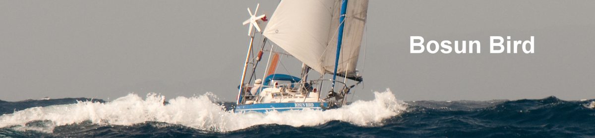
From Ikeda we made another – longer this time – overnight run: straight across Queen Charlotte Sound to Cape Scott, on Vancouver Island. At 170 miles, it means that you are well out of sight of land for much of the passage, the first time we had been so for several years. It took us a while to get used to managing our trusty Aries windvane once more; it was with nostalgia that we recalled the countless similar nights we had spent under way as, in Tarka and Bosun Bird, we sailed the best part of 70,000 miles.


Landfall was on Triangle Island, 35 miles off Cape Scott. It’s a seabird reserve so we weren’t that surprised to be followed for several hours by a group of black-footed albatrosses, a species that is rarely seen close to Vancouver Island itself. The anchorage for that night was at an old haunt: Sea Otter Cove, where in 1984 we had disgraced ourselves by running aground. This is one of only a very few locations left on the coast where the Department of Fisheries and Oceans (DFO) still maintains mooring buoys; where the waters is shallow and the swinging room restricted, as here, these are welcome indeed.


 On to Winter Harbour for supplies and more diesel, then Cape Cook: “the Cape Horn of BC”. Uncharacteristically, it was a warm, sunny day with light winds as we rounded the Cape (actually Solander Island, which does happen to look like Cape Horn). Unlike in 1984, there were no fishing boats to dodge here: commercial fishing is all but dead on the west coast these days.
 At Kyuquot, our stay at the town wharf coincided with the weekly arrival of the MV Uchuk (or “Upchuck” as seasick-prone passengers have been known to call here). The Uchuk, a 1942-built minesweeper converted to carry cargo, is a legend in these parts but remains a going concern only because of the tourists and kayakers she carries; cargo is these days more quickly and cheaply shipped in by fast runabouts from nearby roadheads such as Fair Harbour.
Until now, the weather had been often foggy and wet, but south of Cape Cook things warmed up and the string afternoon inflow winds that are typical of high summer became the rule. We raced with some trepidation up a zigzagging channel to Zeballos, the wind following us at every turn – trepidation because there is no anchorage here, just a small marina at which space is often scarce and which has to be approached downwind. But with relief we eased our way in to a vacant 30-foot slot.
There’s not much shopping at Zeballos – a few shelves of dried goods – but the place has character, and since our last visit a restaurant/pub had opened. Still, if you want a good time, we were told, you make the two-hour drive on a logging road to Woss (a gas station and a restaurant); “what happens in Woss stays in Woss” is a local saying.


") Those strong inflow winds mean that many otherwise promising-looking inlets turn out to be disappointing lee shores. So in Nootka Sound we found ourselves reluctantly staying for a day at a marina (Critter Cove), and then (disappointingly) competing for sheltered anchorage with a flotilla of no less than 17 Aspen catamarans on their annual rendezvous/cruise.
Those strong inflow winds mean that many otherwise promising-looking inlets turn out to be disappointing lee shores. So in Nootka Sound we found ourselves reluctantly staying for a day at a marina (Critter Cove), and then (disappointingly) competing for sheltered anchorage with a flotilla of no less than 17 Aspen catamarans on their annual rendezvous/cruise.
Other than the Aspens, there were few boats to be seen, but we did catch up with friends last seen in these same waters three years earlier: US-flagged Cornelia, from Port Townsend. What a lovely surprise when we were about to say farewell until next time, when Madeline presented us with a watercolour of Bosun Bird at anchor – painted without our even noticing!
In Clayoquot and Barkley Sounds we made a point of taking in as many new anchorages as we could (the tally for the entire cruise was over 20) but then the options started to narrow down. At Bamfield we anchored in the very same spot where we had returned from our circumnavigation in 1989. Then it was into the Strait of Juan de Fuca – past old friends like the lighthouses at Cape Beale, Carmanah and Sheringham – and into the haven of Becher Bay, just short of Race Rocks.


By now (early August) the summer weather was here in earnest: calm, foggy mornings, but by late morning the westerly wind would rise rapidly and reach up to 45 knots before dying away in the evening. It was with caution that we chose our moment to round Race Rocks – the southernmost point of Canadian territory in western Canada.
 After weeks of seeing scarcely another boat, we faced the shock of suddenly crowded waters – and scurried quickly home to Salt Spring Island.
For an account of our 2018 cruise to Haida Gwaii, click here. For more detailed information, including GPS references, see Notes for Cruisers – Haida Gwaii.